Box Spring – Ox Canyon – Crest – Red Canyon Hike
In Manzano Mountains East Region
Map File Source: NG Topo
 Hike Key: H10391
Last Updated: 12/15/2020 12:00am
Last Updated By: Marilyn Warrant
Hike Class: D (Difficult)
Hike Distance: 8.6 mi
Minimum Elevation: 7910 ft
Elevation Change: 1980 ft
Total Uphill: 2250 ft
Total Downhill: 2250 ft
Avg. Grade: 10 %
Route Type: Loop
On Trail: Yes
Paved or Gravel Roads: Yes
GPS Advised: Yes
Drive Distance Round Trip: 160 mi
Drive Time One-Way: 1:15
Hiking Seasons: Spring, Summer, and Fall
New Mexico Game Unit: 14
Hike Status: Published
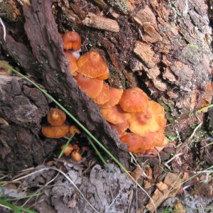
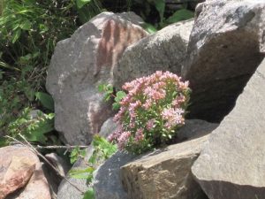
Highlights
Hike in a rocky area of the Manzanos up to the Manzano Crest Trail and down lush Red Canyon.
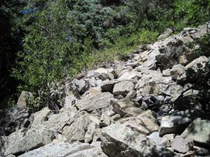
CautionsSome of Ox Canyon is in an old burn area. Hiking poles advised for Red Canyon.
Trailhead Directions
From Albuquerque, take I-40 east to exit 175 for south NM 337. Take 337 south. From the stoplight, head 28.7 miles south on NM 337 through Chilili until the road ends at a T intersection with NM 55. Turn right (west) and continue another 12 miles passing through Tajique and Torreon to the town of Manzano. Watch for a sign which says: Manzano State Park; Red Canyon Campground; NM 131. After going 2.4 miles on NM 131, you are at the entrance to Manzano Mountains state park. Turn right; you are now on a one-lane paved road. 0.5 mi down the road you get to the forest boundary and the road turns to gravel. A few small side roads branch off, but remain on the main road for 1.8 miles, where you will see a sign for the Red Canyon campground. Park at the horse camp at the Red Canyon campground just past the sign for Box Spring.
Actual Hike
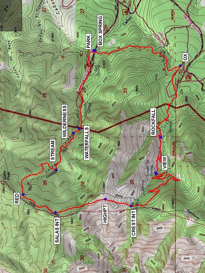
The BOX SPRING (0.0 mi) Trail takes off to the south in the woods from the Red Canyon Campground. Go right (west) up the trail at the intersection with OX (1.3 mi) Canyon trail. At first you’ll see some evidence of recent fires, but fortunately you pass that quickly. There are some extensive ROCKFALLs (2.4 mi). While there’s no stream along the trail, you’ll go by several springs. The Lower Ox Spring near VIEW (3.1 mi) may produce enough water for a side stream. There are a number of switchbacks that keep the grade at a steady 10%. Have lunch at the intersection with the Manzano Crest Trail (CREST INT (4.7 mi)) at a lovely meadow. Make a turn to the north on the Manzano Crest Trail, watching carefully for cairns, especially at the beginning, on a good trail. You’ll need to go uphill a little further to the HIGHPT (5.1 mi), then the rest is mostly downhill. Go by the intersection with the Salas trail from the west at SALAS INT (5.7 mi). At the intersection with the RED (6.2 mi) Canyon trail, stop to enjoy the meadow and view. Then head down Red Canyon. There’s a STREAM (7.0 mi) that you follow much of the way. Pass the WILDERNESS (7.5 mi) boundary, and stop again at the WATERFALLS (7.6 mi) before you hike the rest of the way to the van.
Comments
Near the waterfalls are some beautiful rock formations. Unfortunately, there is rarely much water in the stream any more.
Hike data were obtained from Garmin BaseCamp using track data recorded by a Garmin GPSMap 60CSx. Trackpoints recorded during lunch were deleted.
WaypointsPARK: N34 37.326, W106 24.697
BOX SPRING: N34 37.308, W106 24.699
OX: N34 36.449, W106 24.884
ROCKFALL: N34 36.645, W106 25.758
VIEW: N34 36.696, W106 26.193
CREST INT: N34 36.947, W106 26.600
HIGHPT: N34 37.206, W106 26.513
SALAS INT: N34 37.708, W106 26.678
RED: N34 38.035, W106 26.459
STREAM: N 4 37.702, W106 26.161
WILDERNESS: N34 37.526, W106 25.711
WATERFALLS: N34 37.468, W106 25.651
Hike GPS File Name: Box-Ox-Crest-RedWayTrack500_MW.gpx
Hike GPS File: Click link to download hike waytrack file
Text Author: Marilyn Warrant
Map Author: Marilyn Warrant
Waypoints Author: Marilyn Warrant
Track Author: Marilyn Warrant
Maintainer: Marilyn Warrant
Editor: Howard Carr