El Morro National Monument – Headland Trail Hike
In El Malpais Region
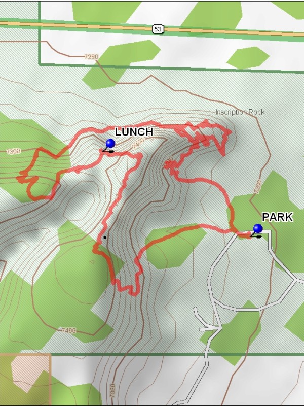
Map File Source: DeLorme
 Hike Key: H10287
Last Updated: 12/15/2020 12:00am
Last Updated By: Marilyn Warrant
Hike Class: C (Challenging)
Hike Distance: 2.3 mi
Minimum Elevation: 7210 ft
Elevation Change: 240 ft
Total Uphill: 795 ft
Total Downhill: 795 ft
Avg. Grade: 17 %
Route Type: CCW Loop
On Trail: Yes
Paved or Gravel Roads: Yes
GPS Advised: No
Drive Distance Round Trip: 244 mi
Drive Time One-Way: 2:15
Hiking Seasons: Spring, Fall, and Winter
New Mexico Game Unit: 10
Hike Status: Published
Highlights
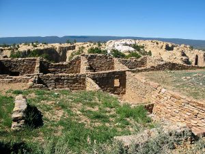
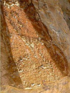
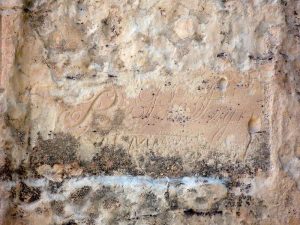
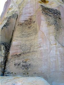
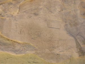
Spanish and Anglo inscriptions and pre-historic petroglyphs. Ancestral Puebloan ruin. Atsinna, a “place of writings on rock.”
CautionsSteep, so hiking poles recommended.
Trailhead Directions
From Albuquerque, take I-40 W for 80 mi to exit 81 for NM-53/NM-122 toward I-40 BUS/Grants/San Rafael. After 0.2 mi., turn left at NM-122 E/NM-53 W. Continue to follow NM-53 W for 41.6 mi to El Morro National Monument Rd, Ramah, NM and PARK (0.0 mi).
Actual Hike
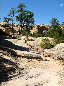
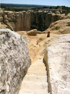
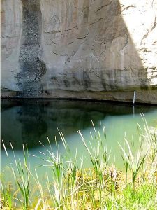
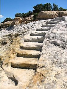
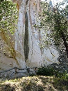
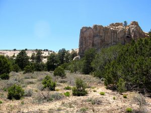
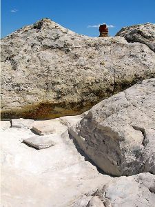
This 2 mile loop includes the Inscription Trail, and continues to the top of the bluff. There, you will be rewarded with spectacular views of the Zuni Mountains, the volcanic craters of the El Malpais area, and the El Morro valley. A 250 ft. elevation gain and the uneven sandstone surface makes this a slightly strenuous hike. The Inscription Trail goes to the pool and past hundreds of Spanish and Anglo inscriptions, as well as pre-historical petroglyphs. Along the trail is the Ancestral Puebloan ruin, Atsinna, or “place of writings on rock”. Between approximately 1275 to 1350 AD, up to 1500 people lived in this 875 room pueblo. The location was strategic, it was near the only water source for many miles and located atop a nearly impenetrable bluff. Atsinna was partially excavated in the 1950s and masons and archeologists continue to work towards its stabilization. Find a spot with a good view for LUNCH (1.5 mi).
Comments
Portions or all of the Headland Trail can close due to ice and snow during the winter months (December -April), so consider the weather before leaving for this hike. Trails are open from 9 AM to 4 PM most of the year (9 AM to 5 PM) in the summer.
WaypointsPARK: N 35 02.304, W 108 20.930
LUNCH: N 35 02.435, W 108 21.209
Hike GPS File Name: ElMorroNationalMonument-HeadlandTrailWayTrack_MLML.gpx
Hike GPS File: Click link to download hike waytrack file
Text Author: Mike Lippke
Map Author: Marilyn Warrant
Waypoints Author: Mike Lippke
Track Author: Mike Lippke
Maintainer: Dawn McIntyre
Editor: Marilyn Warrant