Deer Creek Extended Hike
In Jemez Mountains Region
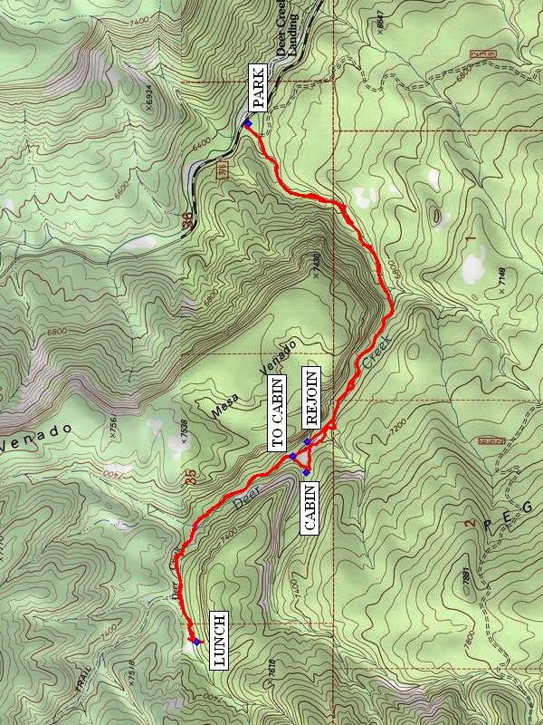
Map File Source: NG Topo
 Hike Key: H10248
Last Updated: 12/15/2020 12:00am
Last Updated By: Marilyn Warrant
Hike Class: C (Challenging)
Hike Distance: 6.1 mi
Minimum Elevation: 6375 ft
Elevation Change: 900 ft
Total Uphill: 995 ft
Total Downhill: 995 ft
Avg. Grade: 8 %
Route Type: InOut
On Trail: No
Paved or Gravel Roads: Yes
GPS Advised: Yes
Drive Distance Round Trip: 110 mi
Drive Time One-Way: 1:30
Hiking Seasons: Spring, Summer, and Fall
New Mexico Game Unit: 6A
Hike Status: Published
Highlights
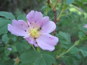
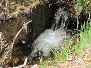
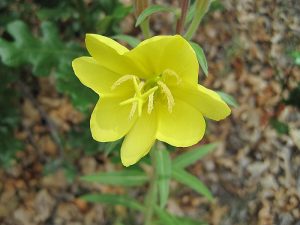
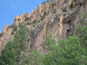
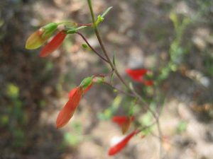
Rock formations, creek, wildflowers.
CautionsHike along rocky road.
Trailhead Directions
North on I-25 to exit 242, west on US 550 23 miles to San Ysidro, north on SR 4 past Jemez Pueblo and milepost 9 to SR 485. Follow SR 485 NW for 6.6 miles to trail head. You will pass through Gilman tunnels and SR 485 turns into unpaved FR 376 at the end of the pavement just beyond the tunnels. Drive a mile past that and PARK (0.0 mi) on the left just before a fence with cattle guard.
Actual Hike
Follow the old road along a very tall and nearly vertical canyon wall (Mesa Venado “Deer Mesa”) with hoodoo features on the right and a small stream on the left. There are options to take trails to your right, but stay along the stream. Go as far as you’d like, then have LUNCH (3.0 mi). On the way back, make a detour at TO CABIN (4.2 mi) to see the ruins of a log CABIN (4.3 mi). On your way back to REJOIN (4.5 mi) the old road, be sure to look up at the view of the cliffs. Continue down the road back to the parking area.
Comments
This hike can be hot. The old road is rocky, so hiking sticks are helpful.
WaypointsPARK: N 35 44.784, W 106 46.768
LUNCH: N 35 44.954, W 106 48.825
TO CABIN: N 35 44.634, W 106 48.108
CABIN: N 35 44.596, W 106 48.153
REJOIN: N 35 44.593, W 106 48.032
Hike GPS File Name: DeerCreekExtendedWayTrack_MWMW.gpx
Hike GPS File: Click link to download hike waytrack file
Text Author: Hans Quack
Map Author: Marilyn Warrant
Waypoints Author: Marilyn Warrant
Track Author: Marilyn Warrant
Maintainer: Marilyn Warrant
Editor: Howard Carr