Winsor Trail to Bob Meadow Hike
In Sangre De Cristos Region
Map File Source: NG Topo
 Hike Key: H10241
Last Updated: 12/15/2020 12:00am
Last Updated By: Marilyn Warrant
Hike Class: C (Challenging)
Hike Distance: 5.2 mi
Minimum Elevation: 10257 ft
Elevation Change: 589 ft
Total Uphill: 1375 ft
Total Downhill: 1375 ft
Avg. Grade: 13 %
Route Type: InOut
On Trail: No
Paved or Gravel Roads: Yes
GPS Advised: Yes
Hiker Limit (NF/BLM/NP): 15 (Pecos Wilderness)
Drive Distance Round Trip: 150 mi
Drive Time One-Way: 1:45
Hiking Seasons: Summer and Fall
New Mexico Game Unit: 44
Hike Status: Published
Highlights
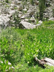
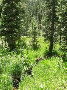
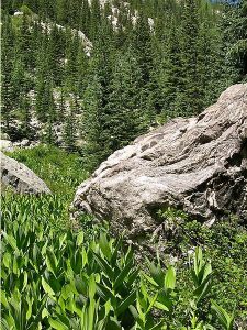
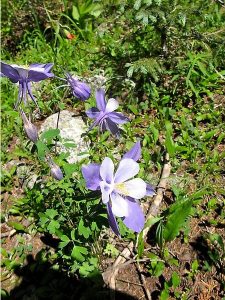
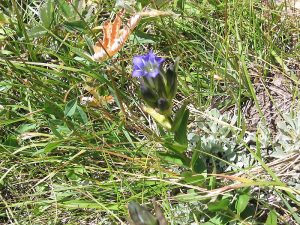
Beautiful mountain hike to a lovely meadow, with views of the stream and surrounding mountain peaks to the south.
CautionsA strenuous hike that can be done at a moderate pace.
Trailhead Directions
Take I-25 north to Santa Fe. Take the Old Pecos Trail exit 284 and follow to Paseo de Peralta. Turn right and follow to Washington Avenue, just before the pink Masonic Temple. Turn north on Washington, then east on Artist Road, which becomes Hyde Park Rd., which leads to the ski area 17 miles distant. The trail begins at the northwest corner of the lower parking area.
Actual Hike
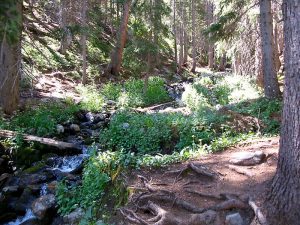
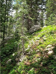
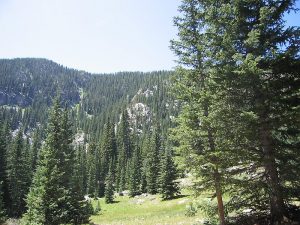
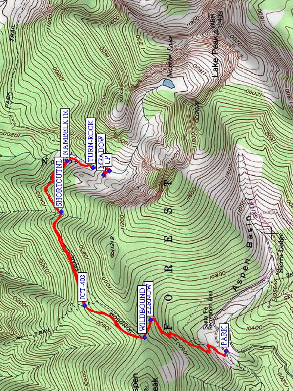
The hike follows Winsor Trail (#254) and begins at 10,250′ elevation. There is an initial 600′ ascent from the ski area using long switchbacks through the forest to the Pecos Wilderness boundary (WILDBOUND (0.8 mi)). A very gradual descent follows for about 2 miles (total elevation loss about 550′). You’ll pass the junction with Lower Nambe Trail JCT-403 (1.2 mi). One approach is to pass the Nambe Lake Trail to the right (NAMBELKTR (2.3 mi)) and take the steep trail up along the rushing stream then UP (2.6 mi) to the MEADOW (2.6 mi). The simplest approach is to take the Nambe Lake Trail #400 to the right (NAMBELKTR (2.3 mi)). After you’ve crossed the stream for the second time (you’re now on the right-hand-side of the stream again), go away from the trail and up to the meadow. Eat your lunch there, with a view of the stream or the surrounding mountain peaks to the south. The hike is strenuous with a great stream and mountain experience in late spring / early summer.
Comments
We named this meadow “Bob’s Meadow” in honor of the trip leader, Bob Schwartz. We had intended to go to Puerto Nambe, but decided not to cross the stream and see what we could find. It turned out to be this beautiful little meadow. This is one of the few hikes from this trailhead that can be done at a moderate pace and still get back to the senior center before 5 PM. Another option (easier to find on the way back) would be to try the “shortcut” between SHORTCUTNL (1.9 mi) and TURN-ROCK (2.5 mi) recorded by Ken Smith for the Nambe Lake hike.
WaypointsPARK: N 35 47.728, W 105 48.263
EZRNOW: N 35 48.112, W 105 48.070
WILDBOUND: N 35 48.144, W 105 48.180
JCT-403: N 35 48.446, W 105 47.983
SHORTCUTNL: N 35 48.566, W 105 47.401
NAMBELKTR: N 35 48.534, W 105 47.087
TURN-ROCK: N 35 48.406, W 105 47.127
MEADOW: N 35 48.350, W 105 47.173
UP: N 35 48.320, W 105 47.148
Hike GPS File Name: WinsorTrailtoBobMeadowWayTrack_MWMW.gpx
Hike GPS File: Click link to download hike waytrack file
Text Author: Marilyn Warrant
Map Author: Marilyn Warrant
Waypoints Author: Marilyn Warrant
Track Author: Marilyn Warrant
Maintainer: Dawn McIntyre
Editor: Marilyn Warrant