Pine Shadow Hike
In Manzano Mountains East Region
Map File Source: NG Topo
 Hike Key: H10176
Last Updated: 12/15/2020 12:00am
Last Updated By: Marilyn Warrant
Hike Class: D (Difficult)
Hike Distance: 5.4 mi
Minimum Elevation: 7263 ft
Elevation Change: 1581 ft
Total Uphill: 1615 ft
Total Downhill: 1615 ft
Avg. Grade: 13 %
Route Type: InOut
On Trail: Yes
Paved or Gravel Roads: Yes
GPS Advised: Yes
Drive Distance Round Trip: 145 mi
Drive Time One-Way: 1:45
Hiking Seasons: Spring and Fall
New Mexico Game Unit: 14
Hike Status: Published
Highlights
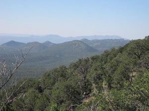
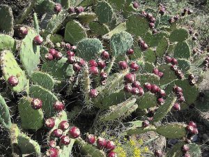
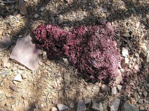
Views from the southern end of the Manzanos. Wildflowers, bear scat on occasion.
CautionsSteep and can be hot; bring hiking poles and extra water. Narrow trail with exposure on one side.
Trailhead Directions
I-25 south to exit 195. Go through Belen on Bus. 25, under an overpass and over RR tracks. At Reinken, go left on SR 309 heading for mountains, cross Rio Grande then southeast on SR 47 to US 60, east on US 60. After crossing RR, and just before milepost 191 look for brown Forest Service sign. Turn left (north) there and follow FR 422 about 10 mi. to trailhead at Pine Shadow Spring. An alternate route begins at town of Manzano on FR 253 to FR 422 to trailhead and PARK (0.0 mi). We made both routes 11/98 in a loop and it was only five miles shorter and 15 min. quicker going via Manzano than Belen.
Actual Hike
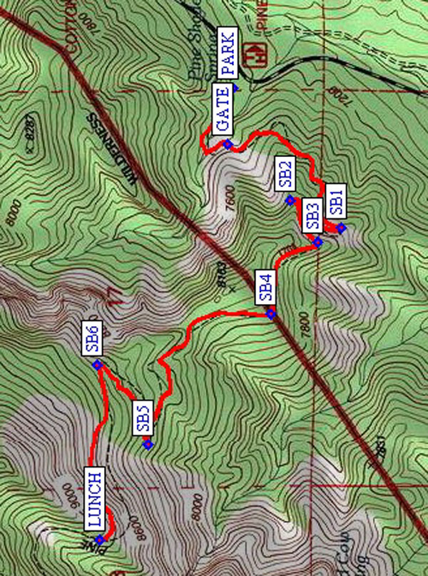
Trail 170A begins at a broken-down, confusing sign not far from the trailhead. Go left (south) there instead of going straight ahead. First three switchbacks (SB1 (0.7 mi), SB2 (0.9 mi), and SB3 (1.0 mi)) climb the SE face. Then you go around the SW face between switchbacks SB3 (1.0 mi) and SB4 (1.3 mi). Great panoramic views to the south. There’s a nice overlook on the ridge (to NE and SW) before the next switchback. We continued past SB5 (1.9 mi) to have our lunch in ’98 and ’99. A better objective is to continue on past SB6 (2.2 mi) to switchback 7 where we had LUNCH (2.7 mi) in 2009 and got very cold. In spring with much wind, you might want to go lower down for lunch.
Comments
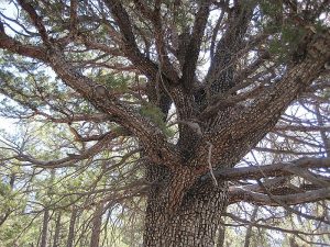
Trail extends to Manzano Peak (5.5 miles and nearly 3,000 ft.). Lots of weathered and twisted alligator junipers. The rocks in the Manzanos are so different than in other places. The schist that looks like fish skin is common in the Manzanos, but on the southern end we find a lot of quartz-like rocks in brownish purples and creams – like candy. On the ’98 hike we saw fresh bear paw prints in the mud. This hike gets a lot of sun.
WaypointsPARK: N 34 34.046, W 106 26.079
GATE: N 34 34.059, W 106 26.231
SB1: N 34 33.802, W 106 26.460
SB2: N 34 33.916, W 106 26.383
SB3: N 34 33.857, W 106 26.496
SB4: N 34 33.960, W 106 26.694
SB5: N 34 34.236, W 106 27.045
SB6: N 34 34.350, W 106 26.832
LUNCH: N 34 34.345, W 106 27.304
Hike GPS File Name: PineShadowWayTrack_MWMW.gpx
Hike GPS File: Click link to download hike waytrack file
Text Author: Roger Holloway
Map Author: Marilyn Warrant
Waypoints Author: Marilyn Warrant
Track Author: Marilyn Warrant
Maintainer: Marilyn Warrant
Editor: Howard Carr