Rio Rancho Bosque Hike
In Rio Rancho Region
Map File Source: DeLorme
 Hike Key: H10067
Last Updated: 02/07/2022 12:00am
Last Updated By: Marilyn Warrant
Hike Class: B (Moderate)
Hike Distance: 5 mi
Minimum Elevation: 5040 ft
Elevation Change: 45 ft
Total Uphill: 300 ft
Total Downhill: 300 ft
Avg. Grade: 1 %
Route Type: InOut
On Trail: Yes
Paved or Gravel Roads: Yes
GPS Advised: No
Drive Distance Round Trip: 30 mi
Drive Time One-Way: 0:45
Hiking Seasons: Spring, Fall, and Winter
New Mexico Game Unit: 9
Hike Status: Published
Highlights
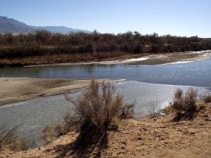
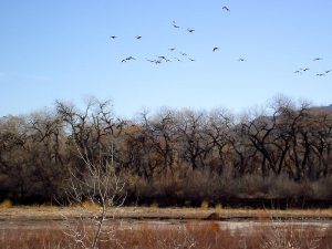
Bluff views of the river, wander among the cottonwoods. In the fall there is great color. Sandhill cranes and ducks may be seen on the river.
CautionsNone.
Trailhead Directions
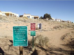
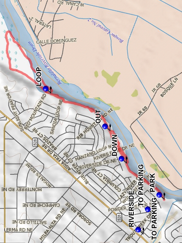
In Albuquerque, from I 25, exit at Alameda (Hwy 528), follow Hwy 528 west for 5.3 miles to Coors and Alameda intersection. Continue north on Hwy 528 for an additional 6.3 miles, past Intel and about 1 mile past Corrales Rd (Hwy 448) to the light at Riverside Dr. Turn east (right) on Riverside Drive, pass the park on the right, cross the culvert at the end of the park, turn right onto the unmarked dirt road that leads downhill to the parking area.
Actual Hike
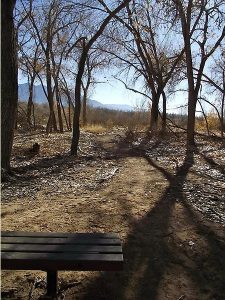
Pass around the gate at the north end of parking and take the trail along the edge of the bluff. There is a good view of the Rio Grande to the north. In early winter there may be many Sandhill Cranes on the river and along its banks. It is possible to go DOWN (0.5 mi) into the Bosque and walk in the Bosque among the cottonwoods. After about 0.4 miles the trail gets pinched down. Go up OUT (0.9 mi) of the Bosque onto the trail above. Continue northward, staying near the cliff edge. The trail drops down to meet a wide LOOP (1.7 mi) pathway, the Rio Rancho Bosque Preserve path. This is a well maintained loop of about 1.7 miles. After completing the loop return back southward to parking.
Waypoints
CORRALES ROAD: N35 16.515, W106 37.049
RIVERSIDE: N35 17.248, W106 36.263
TO PARKING: N35 17.167, W106 36.050
PARK: N35 17.068, W106 35.901
DOWN: N35 17.392, W106 35.523
OUT: N35 17.532, W106 35.184
LOOP: N35 18.039, W106 34.789
Hike GPS File Name: RioRanchoBosqueWayTrack_DBDB.gpx
Hike GPS File: Click link to download hike waytrack file
Text Author: Dick Brown
Map Author: Marilyn Warrant
Waypoints Author: Dick Brown
Track Author: Dick Brown
Maintainer: Dawn McIntyre
Editor: Marilyn Warrant