San Antonio Hot Spring Hike
In Jemez Mountains Region
Map File Source: DeLorme
 Hike Key: H10000
Last Updated: 12/15/2020 12:00am
Last Updated By: Marilyn Warrant
Hike Class: B (Moderate)
Hike Distance: 5.5 mi
Minimum Elevation: 8295 ft
Elevation Change: 440 ft
Total Uphill: 615 ft
Total Downhill: 615 ft
Avg. Grade: 7 %
Route Type: CCW Loop
On Trail: No
Paved or Gravel Roads: No
GPS Advised: Yes
Drive Distance Round Trip: 160 mi
Drive Time One-Way: 2:00
Hiking Seasons: Summer and Fall
New Mexico Game Unit: 6A
Hike Status: Published
Highlights
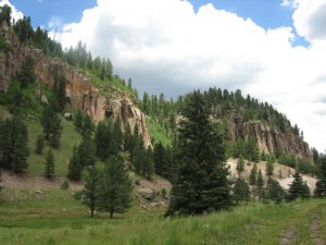
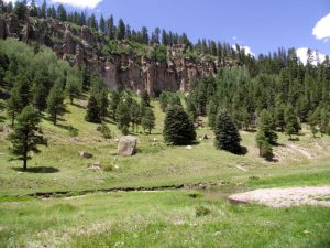
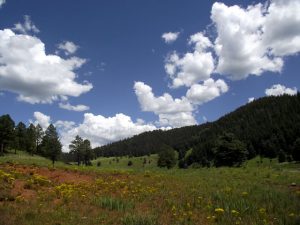
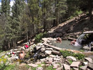
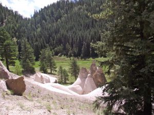
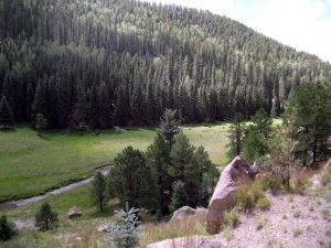
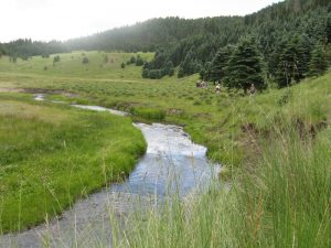
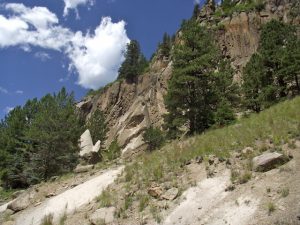
Bucolic pasture land, wandering stream, tent rocks, and sandstone cliffs. Natural hot springs at the end.
CautionsBecause of the steep ascent out of the canyon and the fact that the river crossing requires wading, hiking poles are recommended.
Trailhead Directions
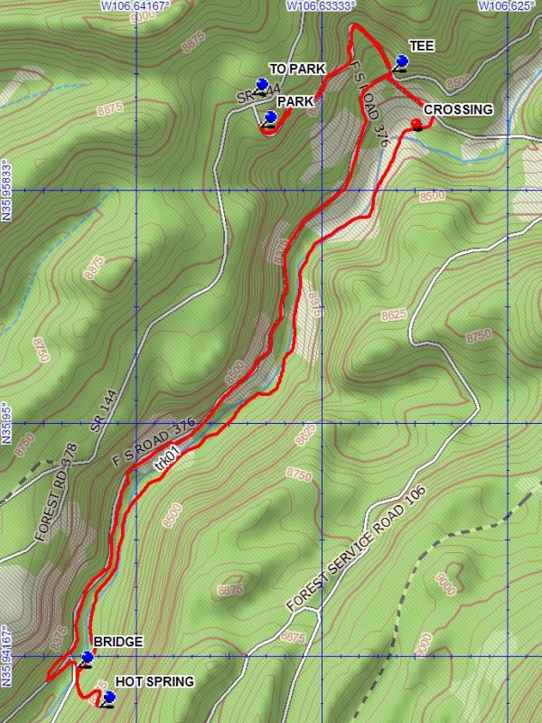
From Albuquerque take I-25 north to Bernalillo. From Bernalillo take US 550 to San Ysidro. Take SR 4 north to La Cueva. Go west on SR 126 to FR 144 on your right (just past mile marker 33). Turn right and proceed 6.5 miles to PARK (0.0 mi).
Actual Hike
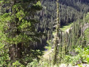
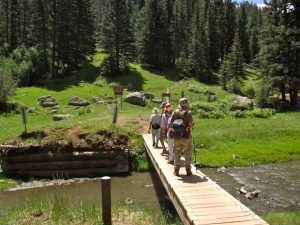
Find the closed logging road (FR 106, no signs) on the right side of FR 144 that that goes down the west side of San Antonio canyon to the floor of the canyon. At the TEE (0.6 mi) turn right and hike south on the west side of San Antonio Creek to the area of the hot springs, about 1.8 miles. Go through the fence blocking the road and on for about 100 yards and turn hard left on the road to the BRIDGE (2.5 mi) and cross on the bridge to the east side of the canyon. To visit the HOT SPRING (2.7 mi), go up the east side of the canyon about 0.2 miles on the obvious trail then return back down the trail. The hike continues near the bridge on the east side of the creek. Hike back up the valley on the east side of San Antonio Creek to a fenced area. CROSSING (4.6 mi) the creek here will involve wading the shallow spot just south of the fence. Go right and up the hill on a faint two track to a worn two track and go left on that track to the TEE. Continue up the hill , backtracking up the west side of the canyon to the parking.
Comments
Because FR 376, the old way to the springs has been closed due to deterioration, the starting point for this hike was changed. New fenced areas have shortened the hike.
WaypointsFR 144: N35 53.393, W106 40.022
TO PARK: N35 57.707, W106 38.191
PARK: N35 57.638, W106 38.167
TEE: N35 57.757, W106 37.813
BRIDGE: N35 56.478, W106 38.660
HOT SPRING: N35 56.392, W106 38.600
CROSSING: N35 57.643, W106 37.748
Hike GPS File Name: SanAntonioHotSpringWayTrack_DBDB.gpx
Hike GPS File: Click link to download hike waytrack file
Text Author: Dick Brown
Map Author: Dick Brown
Waypoints Author: Dick Brown
Track Author: Dick Brown
Maintainer: Cindy McConnell
Editor: Howard Carr