Calaveras Canyon – Big Side Canyon Hike
In Jemez Mountains Region
Map File Source: NG Topo
 Hike Key: H10461
Last Updated: 12/15/2020 12:00am
Last Updated By: Marilyn Warrant
Hike Class: B (Moderate)
Hike Distance: 6.5 mi
Minimum Elevation: 8100 ft
Elevation Change: 500 ft
Total Uphill: 500 ft
Total Downhill: 500 ft
Avg. Grade: 5 %
Route Type: InOut
On Trail: No
Paved or Gravel Roads: Yes
GPS Advised: Yes
Drive Distance Round Trip: 168 mi
Drive Time One-Way: 2:00
Hiking Seasons: Spring, Summer, and Fall
New Mexico Game Unit: 6A
Hike Status: Published
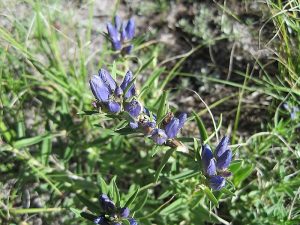
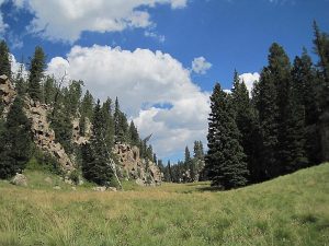
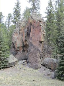
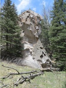
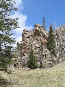
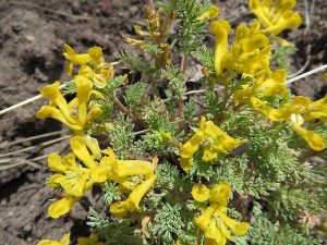
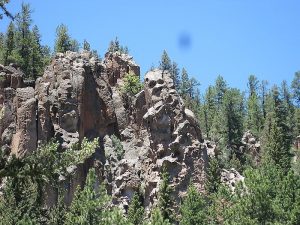
Attractions: Forest, Rock Formations, Water Features, and Wildflowers
Highlights
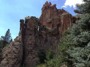
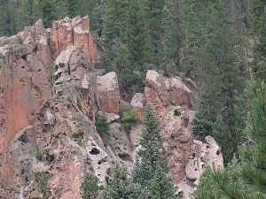
A chance to see the Calaveras “skulls” – face to face! Wildflowers, rock formations, green valley.
CautionsNone.
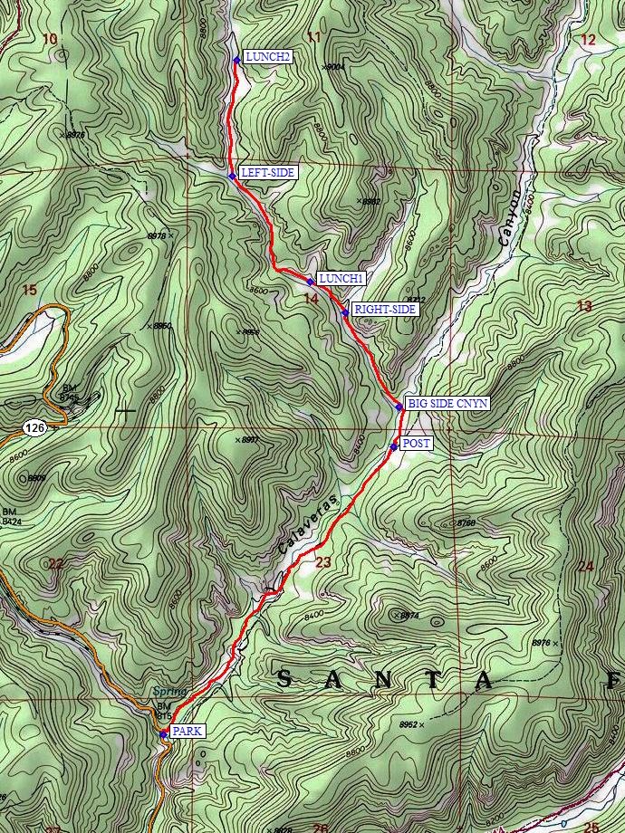
Trailhead DirectionsFrom Albuquerque take I-25 North to Bernalillo, US 550 west to San Ysidro, SR 4 north to La Cueva, left (west) on SR 126. Once Fenton Lake is reached, it will be 4.0 miles from the end of the bridge which crosses the marsh to parking. Go past the turnoff to Seven Springs and cross a couple of bridges then look for the refurbished parking area on the right that now could hold 3 vans easily. PARK (0.0 mi) there.
Actual HikeThe first part of this hike is the same as several other “Calaveras Canyon” hikes. Follow the wash down to a 6″ pipe and go left along the pipe. A dirt road will take you up a hill where there is a gate. When you come down you will come upon a Water Quality Control project by UNM with many “mushrooms” of pvc pipe and a weather station. After about a mile, a rock formation that looks like a castle tower will appear. One of the formations, also about a mile in from the road, looks like a skull from the front, but like a gorilla or ape from the side.
After a POST (1.45 mi), take a left on a hard-to-see old road into the BIG SIDE CNYN (1.65 mi) (if you’ve reached the WATERMETER you’ve gone too far). The old road becomes more like an animal trail the further you go up the canyon. Just past the RIGHT-SIDE (2.1 mi) canyon is one lunch spot at LUNCH1 (2.25 mi). There’s a LEFT-SIDE (2.8 mi) canyon further on, and another good lunch spot at LUNCH2 (3.3 mi). As you go further up the canyon the grass gets higher and the effort to step greater.
CommentsHere’s your chance to look at some of those fascinating “face” rocks at eye level. There are many places to stop and admire the scenery. On an exploratory hike, we saw wild turkeys, a hawk, and a grouse. There were several places where deer or elk had bedded down recently. You can reduce this hike to as little as 4.5 mi and still have a great hike. Note that the upper part of this hike can be marshy at times. Thanks to those who came along on the exploratory.
WaypointsPARK: N35 56.455, W106 42.383 (0.0 mi)
POST: N35 57.386, W106 41.467 (1.45 mi)
BIG SIDE CNYN: N35 57.514, W106 41.444 (1.65 mi)
WATERMETER: N35 57.558, W106 41.386
RIGHT-SIDE: N35 57.820, W106 41.660 (2.1 mi)
LUNCH1: N35 57.921, W106 41.800 (2.25 mi)
LEFT-SIDE: N35 58.265, W106 42.112 (2.8 mi)
LUNCH2: N35 58.639, W106 42.093 (3.3 mi)
Hike GPS File Name: CalaverasCanyon-BigSideCanyonWayTrack1_MW.gpx
Hike GPS File: Click link to download hike waytrack file
Text Author: Marilyn Warrant
Map Author: Marilyn Warrant
Waypoints Author: Marilyn Warrant
Track Author: Marilyn Warrant
Maintainer: Marilyn Warrant
Editor: Howard Carr