Posi Ruins Joseph’s Mine Ojo Caliente Hike
In Santa Fe Region
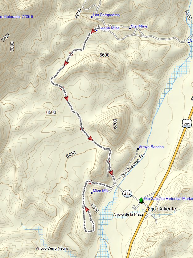
Map File Source: Garmin BaseCamp
 Hike Key: H10695
Last Updated: 04/22/2024 2:23pm
Last Updated By: Dawn McIntyre
Hike Class: C (Challenging)
Hike Distance: 5.5 mi
Minimum Elevation: 6220 ft
Elevation Change: 735 ft
Total Uphill: 1020 ft
Total Downhill: 1020 ft
Avg. Grade: 4 %
Route Type: InOut
On Trail: Yes
Paved or Gravel Roads: No
GPS Advised: No
Drive Distance Round Trip: 107 mi
Drive Time One-Way: 2:00
Hiking Seasons: Spring, Fall, and Winter
New Mexico Game Unit:
Hike Status: Published
Highlights
You get a 2 for 1 on this hike with a large collection of pottery and mica from the mines.
CautionsThe initial ascent is rocky and steep.
Trailhead DirectionsDrive I-25 to exit 276- 44.7 miles and head west on Highway 599. At 13.1 miles merge on to US 285/84. Continue 22 miles on 285. When you reach Espanola, there are two ways to get to Highway 84/285 and across the Rio Grande. You will need to turn left at either light and then turn right onto 84/285. When you reach the last gas station on the northern edge of Hernandez, 84 and 285 split, turn right to US 285. Stay on 285 until you reach the Ojo Caliente Hot Springs parking lot on the left. The trail head is next to the office and is well-marked.
Actual HikeThe initial start of the P’osi Ruin Trail is up the steep mesa slope. Poles may be required. Once on top, the trail is fairly level. The trail takes you to the P’osiowingeh ruin meaning “where the water comes to a point” pueblo. The P’osi Pueblo Ruins date from the late 1300 to early 1500s prior to the Spanish arrival. This pueblo is related to the current Tewa who now live along the Rio Grande.
Along the meandering paths are rocks with pottery shards placed so hikers can view the variety of pots that are here.
Joseph’s Mica Mine Trail starts up the same steep mesa slope and then follows the relatively level canyon valley to several historic mica mines. The mines and the mica recovered is quite amazing. You’ll see a large hole with three caves perched overhead. Follow the trail around the edge of the hole and enjoy the vista. Area past the Mica Mines is unmarked and may vary from the map. It is recommended not to pass beyond them.
CommentsNote: this hike has limited shade available. The tracks were obtained from AllTrails.
Map Filename: OjoCalienteHikesMap_MW.jpgHike GPS File Name: OjoCalienteHikesTrack_MW.gpx
Hike GPS File: Click link to download hike waytrack file
Text Author: Cathy Intemann
Map Author: Marilyn Warrant
Waypoints Author:
Track Author: Marilyn Warrant
Maintainer: Cathy Intemann
Editor: Dawn McIntyre