Santa Fe River Wade Hike
In Santa Fe Region
Map File Source: Garmin BaseCamp
 Hike Key: H10620
Last Updated: 09/13/2023 1:20pm
Last Updated By: Dawn McIntyre
Hike Class: D (Difficult)
Hike Distance: 5.2 mi
Minimum Elevation: 5840 ft
Elevation Change: 385 ft
Total Uphill: 550 ft
Total Downhill: 550 ft
Avg. Grade: 6 %
Route Type: InOut
On Trail: No
Paved or Gravel Roads: No
GPS Advised: Yes
Drive Distance Round Trip: 100 mi
Drive Time One-Way: 1:15
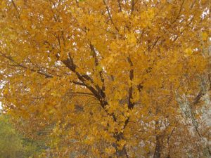
Hiking Seasons: Fall
New Mexico Game Unit: 6C
Hike Status: Published
Attractions: Historical Sites and Water Features
Highlights
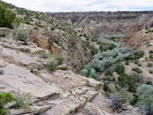
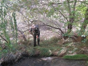
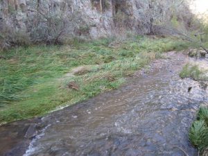
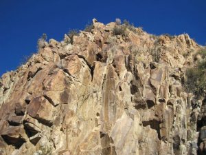
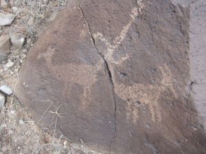
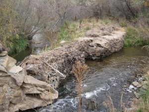
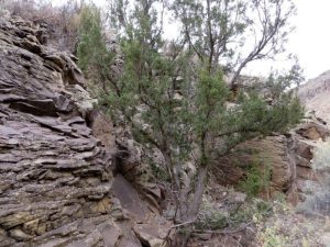
Wading in the stream, green grass, rock canyon walls, petroglyphs, views.
CautionsBushwack through Russian olives, wade knee deep, rocky trail in & out. Wear boots, bring poles and water shoes with toe guards that you can also hike in. Plan to get your hiking pants and socks dirty.
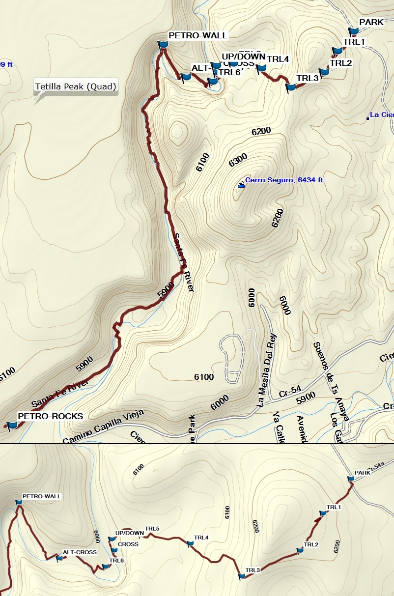
Trailhead DirectionsI-25 North to exit 271 (La Cienega). From the Frontage road, turn left and go over I-25 heading NNW into La Cienega on Santa Fe County Rd 50F (SR587). At a Y intersection at ENTRADA go right. Take a right onto CR54, and a quick left onto CR54B. Go less than a mile on CR54B, turn left on CR54A, then go a short distance to PARK (0.0 mi). The trail starts there and goes up the hill in front of you.
Actual HikeStart out hiking uphill over a ridge on a rocky, steep trail (wear your boots for this part). The trail can be hard to see, so refer to waypoints TRL1 through TRL5 located about every 0.1 mi, if necessary. The trail reaches the river at UP/DOWN (0.5 mi). CROSS (0.6 mi) the stream or go further to your left past TRL6 (0.7 mi) to another crossing at ALT-CROSS (0.8 mi). Change into water shoes. There’s an actual path to the petroglyphs at PETRO-WALL (0.9 mi), but you may need to get into the stream to see them. They are in the canyon wall part way up. After that, hike on one side until you run out of space or the foliage gets too thick, then cross the stream and hike on the other side. Continue that way for 13 or more crossings. (Keeping close to the track will give you an OK way to do that.) Enjoy the green grass and the rocks in the canyon walls around you as you attempt to follow the cow paths. If the vegetation is too lush, another approach is to just walk in the stream. Finally, change back into your boots (if desired) to make your way through some lava rock to a nice display of petroglyphs at PETRO-ROCKS (2.6 mi) on the north side of the stream.
Go back approximately the way you came. After you cross the stream, be sure you go far enough along it to reach the UP/DOWN waypoint, then follow the trail (and/or the TRL waypoints if you can’t see the trail) to return. Otherwise, you may end up too far to the south and have to go up and over a couple of ridges to get back to the van.
CommentsYou wouldn’t think a hike about 5 miles long and 550 feet total uphill would be that difficult. Think again. The hike is almost all off-trail. It’s tiring to fight the thorny Russian olives and walk in rutted cow tracks. Also, every step in the stream requires concentration so you don’t slip and fall in.
Try to schedule this hike when the air temperature isn’t too cool (so you don’t get cold from the stream crossings) or too hot (so you don’t overheat at the end of the hike going up and over the ridge). It would be an even more difficult hike in high water. Fall seems about right.
A GPS is recommended so you can stay on the track and find the petroglyphs. The hike data were obtained using the National Geographic Topo Digital Elevation Model.
WaypointsAccess
EXIT 271: N35 33.049, W106 07.322
CR50F: N35 33.264, W106 07.203
ENTRADA: N35 33.649, W106 07.561
CR54B N35 33.972 W106 07.550
Hike
PARK: N35 34.631, W106 07.883
TRL1: N35 34.578, W106 07.937
TRL2: N35 34.521, W106 07.980
TRL3: N35 34.481, W106 08.092
TRL4: N35 34.531, W106 08.190
TRL5: N35 34.545, W106 08.284
UP/DOWN: N35 34.538, W106 08.341
CROSS: N35 34.521, W106 08.336
TRL6: N35 34.496, W106 08.352
ALT-CROSS: N35 34.509, W106 08.441
PETRO-WALL: N35 34.595, W106 08.518
PETRO-ROCKS: N35 33.577, W106 09.021
Hike GPS File Name: SantaFeRiverWadeWayTrack4_MW.gpx
Hike GPS File: Click link to download hike waytrack file
Text Author: Marilyn Warrant
Map Author: Marilyn Warrant
Waypoints Author: Marilyn Warrant
Track Author: Marilyn Warrant
Maintainer: Marilyn Warrant
Editor: Dawn McIntyre