Chloride Canyon and Town Tour Hike
In Southwest New Mexico Region
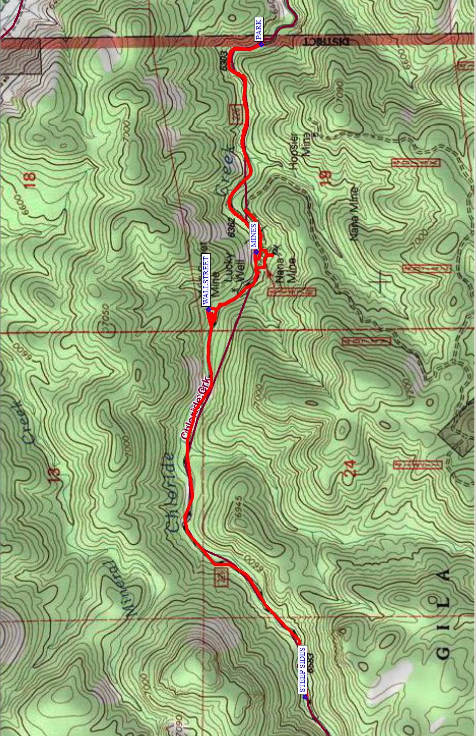
Map File Source: NG Topo
 Hike Key: H10579
Last Updated: 12/15/2020 12:00am
Last Updated By: Marilyn Warrant
Hike Class: B (Moderate)
Hike Distance: 6 mi
Minimum Elevation: 6250 ft
Elevation Change: 500 ft
Total Uphill: 500 ft
Total Downhill: 500 ft
Avg. Grade: 7 %
Route Type: InOut
On Trail: Yes
Paved or Gravel Roads: Yes
GPS Advised: No
Drive Distance Round Trip: 346 mi
Drive Time One-Way: 3:00
Hiking Seasons: Spring, Summer, and Fall
New Mexico Game Unit: 21B
Hike Status: Published
Highlights
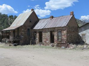
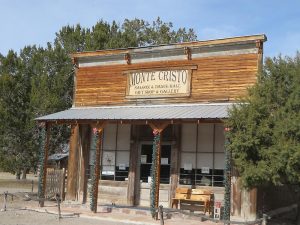
One of the few restored ghost towns in New Mexico.
CautionsHwy. 52 is curvy and hilly in places, and is open range with occasional cattle or deer on or near the road.
Trailhead DirectionsI-25 south to exit 89 (before T or C), then Hwy. 181 south for approx. 3 miles, turn right and go west on Hwy. 52 through Cuchillo and onto Winston (which has a very interesting general store), and continue to the corner. At the corner turn left and go south 2 1/2 miles to Chloride. Total distance from Hwy. 181 to Chloride is 35+ miles.
The road running west out of Chloride becomes FR 226 in 1 1/2 miles at the start of the Gila National Forest, where there is a small parking area.
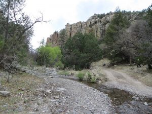
Actual HikeFrom PARK, go north along the road and follow it as it heads westward. Explore the MINES (0.9 mi) and WALLSTREET (1.7 mi). If time permits, continue west on the road to STEEP SIDES (3.2 mi). Return the way you came, without the side excursions.
This is a gravely, dirt, bumpy road that has many shallow creek crossings in the beautiful narrow Chloride Canyon where there are remnants of many mines. You can go on hikes as short or as long as you like in this beautiful canyon.
CommentsDon Edmund (575-743-2736, demund@windstream.net) is the restorer and owner of most of the buildings including the Pioneer Store Museum. For $5 each, Don will lead a historical tour of the town and the Museum. The Pioneer Store was closed in 1923 with all merchandise and town records still inside. It was reopened in 1994 after 4 years of renovation and was added to the State Register of Cultural Properties. The town offers a RV park, vaulted bathrooms and a cafe, the Bank Cafe 575-743-0414, which is located at the former bank building.
Chloride was a bustling silver mining town of 3000 residents in the 1880’s under constant threat of Indian attacks. It had 200 buildings now down to 20. The silver mining was panning out by the 1890’s and the price of silver plummeted by 90% after America went on the gold standard by 1896. Today’s population is 20.
For tours, to see the museum, or eat at the cafe, call the above numbers first to make sure they are open.
WaypointsPARK: N33 20.348, W107 41.722
MINES: N33 20.363, W107 42.435
WALLSTREET: N33 20.500, W107 42.632
STEEP SIDES: N33 20.221, W107 43.961
Hike GPS File Name: ChlorideCanyonWayTrack_FE.gpx
Hike GPS File: Click link to download hike waytrack file
Text Author: Frank Ernst
Map Author: Marilyn Warrant
Waypoints Author: Frank Ernst
Track Author: Frank Ernst
Maintainer: Frank Ernst
Editor: Howard Carr