Stable Mesa to Ruins Hike
In Jemez Mountains Region
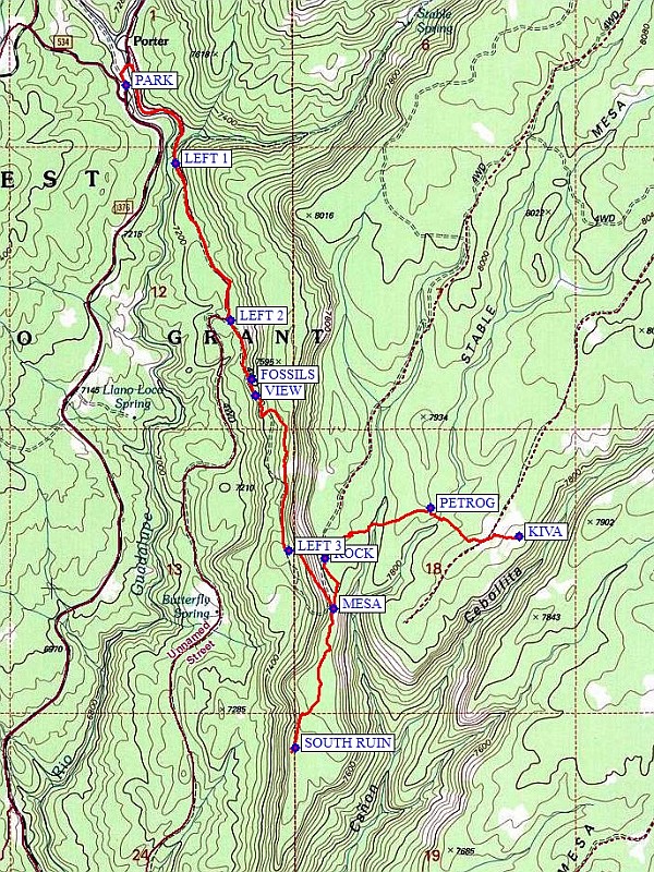
Map File Source: NG Topo
 Hike Key: H10445
Last Updated: 12/15/2020 12:00am
Last Updated By: Marilyn Warrant
Hike Class: C (Challenging)
Hike Distance: 8.2 mi
Minimum Elevation: 7150 ft
Elevation Change: 738 ft
Total Uphill: 1049 ft
Total Downhill: 1049 ft
Avg. Grade: 8 %
Route Type: InOut
On Trail: No
Paved or Gravel Roads: Yes
GPS Advised: Yes
Drive Distance Round Trip: 120 mi
Drive Time One-Way: 1:45
Hiking Seasons: Spring, Summer, and Fall
New Mexico Game Unit: 6A
Hike Status: Published
Highlights
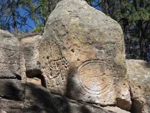
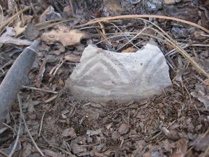
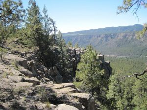
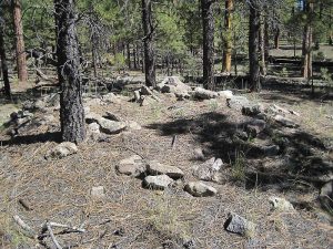
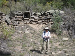
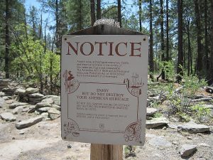
Views, pueblo ruins, a large kiva, petroglyphs, and interesting rocks. Spectacular drive through the Gilman Tunnels with colorful rock cliffs and deep canyon.
CautionsRough rocky road very steep in places (17% grade). Boots with ankle support and good soles plus hiking poles are recommended.
Trailhead DirectionsFrom Albuquerque take I-25 north to Exit 242 at Bernalillo. Exit and go west on US 550 to San Ysidro. Go right (north) on SR 4 to SR 485. Turn left onto SR 485 and drive through the Gilman Tunnels. Follow the road (it becomes FR 376) for 7 miles to PARK (0.0 mi).
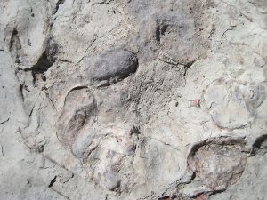
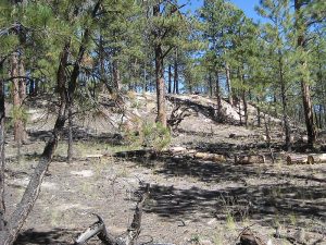
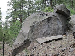
Actual HikeFrom parking go north and cross the Rio Guadalupe on the bridge, and take the faint path on the right. Go uphill for about 100 feet to a road which follows the east bank of the river southward. At about 0.5 miles the mouth of Stable Canyon will be on the left. Continue on this road then take another road at LEFT 1 (0.6 mi) uphill to LEFT 2 (1.2 mi). In the limestone outcroppings, you might find FOSSILS (1.45 mi). There will be many opportunities during the ascent of the west side of the mesa for views out over the surrounding forest, such as at VIEW (1.5 mi). Go uphill to LEFT 3 (2.2 mi), and ascend steeply for about 0.3 miles. This section is rubble covered, so stay on the hill side of the “road” to be safe. Take a break when you reach the MESA (2.4 mi). Turn right and explore the finger mesa to SOUTH RUIN (3.0 mi). Return back to MESA, then keep going straight along the road. Check out the ROCK (3.8 mi) formation and the view below. More ruins are located on a road parallel to this road, but with some ravines in between. Your objective is to avoid the extra ups and downs without going too far north on the road. From ROCK, go east northeast to PETROG (4.3 mi). You can check out the petroglyphs on the rock pile now, or save that for the way back. Admire what you see but do not dig or take things. Veer to your left (southeast) to the large KIVA (4.7 mi). Return back the way you came back to MESA then down the rocky road.
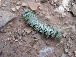
CommentsThe return trip doesn’t have much shade, so it’s better to avoid this hike if the temperature is expected to be hot. Keep an eye on the weather — you don’t want to be going down the steep part in the rain. Hit the right day in late spring, and you might have a lot of buzzing, biting company from the Guadalupe River on the way up the trail. Thanks to Randy Simons for the KIVA waypoint.
Eliminating the south ruin excursion cuts the distance by about 1.2 mi and total vertical by about 140 ft.
WaypointsPARK: N35 49.054, W106 47.256
LEFT 1: N35 48.815, W106 47.071
LEFT 2: N35 48.331, W106 46.861
FOSSILS: N35 48.150, W106 46.783
VIEW: N35 48.100, W106 46.767
LEFT 3: N35 47.620, W106 46.641
MESA: N35 47.443, W106 46.472
SOUTH RUIN: N35 47.015, W106 46.617
ROCK: N35 47.597, W106 46.505
PETROG: N35 47.753, W106 46.105
KIVA: N35 47.665, W106 45.773
Hike GPS File Name: StableMesaToRuinsWayTrack3_MW.gpx
Hike GPS File: Click link to download hike waytrack file
Text Author: Marilyn Warrant
Map Author: Marilyn Warrant
Waypoints Author: Marilyn Warrant
Track Author: Marilyn Warrant
Maintainer: Marilyn Warrant
Editor: Howard Carr