Lower La Luz To La Cueva Overlook Hike
In Sandia Mountain West Region
Map File Source: DeLorme
 Hike Key: H10285
Last Updated: 12/15/2020 12:00am
Last Updated By: Marilyn Warrant
Hike Class: C (Challenging)
Hike Distance: 5.6 mi
Minimum Elevation: 7047 ft
Elevation Change: 1230 ft
Total Uphill: 1328 ft
Total Downhill: 1328 ft
Avg. Grade: 13 %
Route Type: InOut
On Trail: Yes
Paved or Gravel Roads: Yes
GPS Advised: No
Drive Distance Round Trip: 20 mi
Drive Time One-Way: 0:30
Hiking Seasons: Spring, Fall, and Winter
New Mexico Game Unit: 8
Hike Status: Published
Highlights
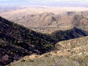
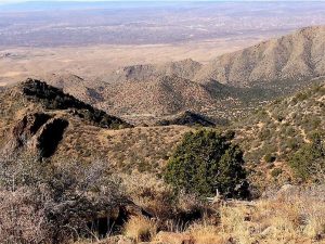
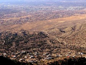
Good views to the west and down into La Cueva Canyon.
CautionsTrekking poles recommended.
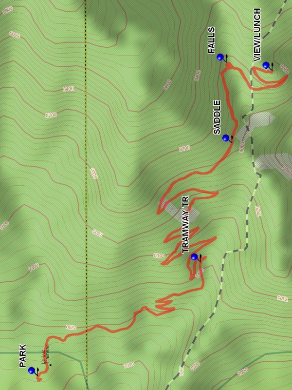
Trailhead DirectionsIn Albuquerque go to Tramway Blvd (SR 556). On Tramway Blvd go to Forest Hwy 333 which at the north end of Tramway in the bend to the west to I-25. Follow 333 northeast into the canyon following signs to La Luz trailhead and PARK (0.0 mi) there.
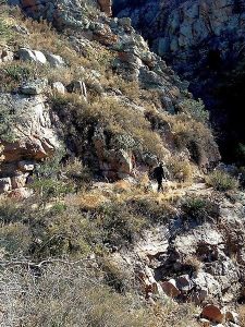
Actual HikeThe trail starts at the east side of the parking lot. The trail starts east uphill, then turns south in a long traverse. After 4 switchbacks the trail heads into a canyon where TRAMWAY TR (0.9 mi) enters from the south. The trail then does 8 switchbacks up a steep slope to the left side of a SADDLE (2.2 mi). The trail then slopes upward more gently to a turn at the FALLS (2.4 mi). There will be water here depending on how dry the weather has been. The trail curves south along the base of a knob, the top of which is the La Cueva Overlook. A switchback takes the trail up the knob to the VIEW/LUNCH (2.8 mi), a nice place for lunch. Return the way you came to parking.
CommentsThere will be westward views for most of the hike. At the destination there is a good view down into La Cueva Canyon. This hike can be hot even in summer because it is westward facing, and there is little tree cover. Bring your hiking sticks — they will be useful on the way back to gain traction.
The Sandia Ranger District has set a 25-hiker limit for this area.
WaypointsPARK: N 35 13.183, W 106 28.850
TRAMWAY TR: N 35 12.815, W 106 28.536
SADDLE: N 35 12.745, W 106 28.209
FALLS: N 35 12.757, W 106 27.986
VIEW/LUNCH: N 35 12.653, W 106 28.008
Hike GPS File Name: LowerLaLuzToLaCuevaOverlookWayTrack_MWMW.gpx
Hike GPS File: Click link to download hike waytrack file
Text Author: Dick Brown
Map Author: Marilyn Warrant
Waypoints Author: Marilyn Warrant
Track Author: Marilyn Warrant
Maintainer: Bill Gloyd
Editor: Marilyn Warrant