Goblin Rocks Loop Hike
In Jemez Mountains Region
Map File Source: DeLorme
 Hike Key: H10117
Last Updated: 12/15/2020 12:00am
Last Updated By: Marilyn Warrant
Hike Class: B (Moderate)
Hike Distance: 3.8 mi
Minimum Elevation: 6860 ft
Elevation Change: 595 ft
Total Uphill: 595 ft
Total Downhill: 595 ft
Avg. Grade: 7 %
Route Type: CW Loop
On Trail: No
Paved or Gravel Roads: Yes
GPS Advised: Yes
Drive Distance Round Trip: 110 mi
Drive Time One-Way: 1:15
Hiking Seasons: Spring, Summer, and Fall
New Mexico Game Unit: 6A
Hike Status: Published
Highlights
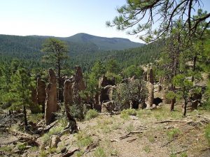
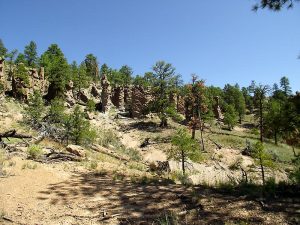
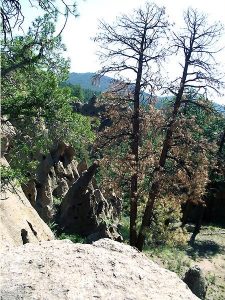
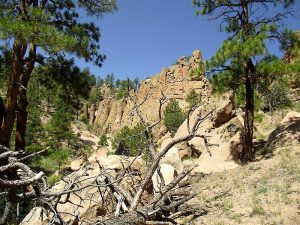
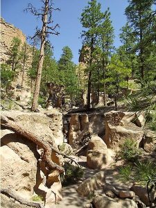
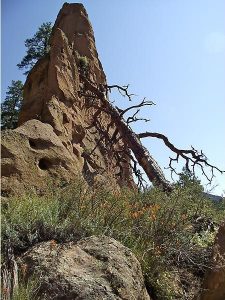
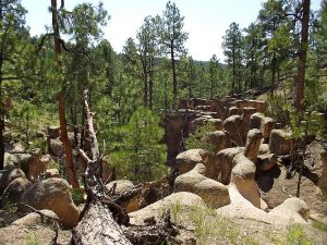
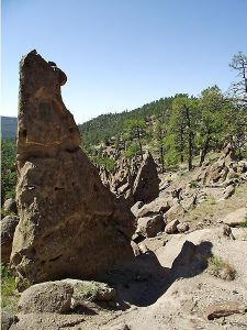
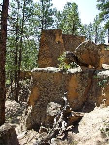
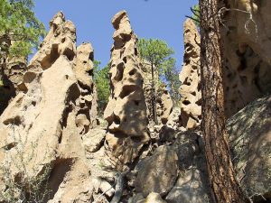
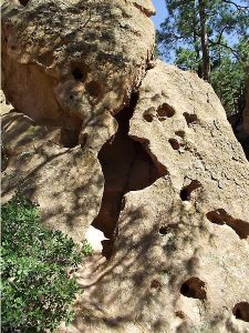
Tent rocks, sandstone & tuff formations eroded to strange shapes, petroglyphs, ending with a walk down Paliza Canyon.
CautionsVery steep sections requiring hiking poles.
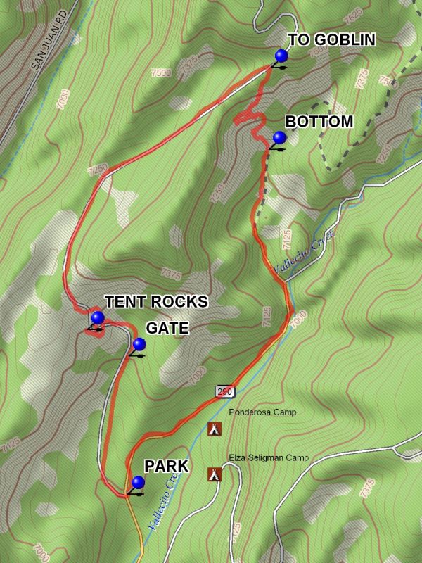
Trailhead DirectionsFrom Bernalillo take US 550 to San Ysidro. Take SR 4 north to the intersection with SR 290. Turn right onto SR 290 and proceed through the town of Ponderosa and past the Paliza campgrounds to a branch in the road. Go left, this is FR 10. About 0.4 miles from the branch there will be an old road bearing right. This is the return route. PARK (0.0 mi) on the right side of the road.
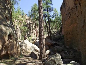
Actual HikeFrom parking the hike continues on Forest Road 10 to some TENT ROCKS (0.7 mi) formations on the left in at the 0.8 mile point. After that the ascent flattens somewhat in a small pine valley, then goes more steeply up the road to the TO GOBLIN (2.0 mi) rocks point. This point is easy to miss. Look for a point where the ridge to the right of the road comes down almost to road level, and there is a widened area in the road. Go over the low rise on the right and goblin formations will be seen. The hike continues by descending through a maze of rock formations. Start by taking a traversing route downward to the right. There is no defined trail and the terrain is very steep. There are many winding routes down. Some do not work. The descent is 300 feet of vertical in 1/2 mile. At the BOTTOM (2.4 mi) turn right and follow an old two track forest road south for 1.3 miles to the Paliza area at PARK (0.0 mi).
CommentsThe route down through the Goblin Rocks area is steep and difficult. The hike can start anywhere along Forest Road 10 at the discretion of the hike leader. The description of the hike assumes a start at the lowest point on FR 10, before the gate. With a shuttle arrangement, the hike can be done starting at the highest point as a down only hike.
Access to this hike may be a problem. If the hike is done in late fall, winter or early spring, the GATE (0.4 mi) on FR 10 may be locked. Check with the USFS if in doubt if the hike is to start beyond the gate. After heavy rain, call the Jemez Ranger District to check on road conditions for FR 10.
WaypointsPARK: N35 42.569, W106 37.646
GATE: N35 42.923, W106 37.642
TENT ROCKS: N35 42.990, W106 37.773
TO GOBLIN: N35 43.662, W106 37.194
BOTTOM: N35 43.452, W106 37.200
Hike GPS File Name: GoblinRocksLoopWayTrack_DBDB.gpx
Hike GPS File: Click link to download hike waytrack file
Text Author: Dick Brown
Map Author: Marilyn Warrant
Waypoints Author: Dick Brown
Track Author: Dick Brown
Maintainer: Dawn McIntyre
Editor: Marilyn Warrant