Cave Creek Hike
In Pecos Region
Map File Source: NG Topo
 Hike Key: H10075
Last Updated: 12/15/2020 12:00am
Last Updated By: Marilyn Warrant
Hike Class: C (Challenging)
Hike Distance: 5.2 mi
Minimum Elevation: 8329 ft
Elevation Change: 571 ft
Total Uphill: 720 ft
Total Downhill: 720 ft
Avg. Grade: 9 %
Route Type: InOut
On Trail: Yes
Paved or Gravel Roads: Yes
GPS Advised: No
Hiker Limit (NF/BLM/NP): 15 (Pecos Wilderness)
Drive Distance Round Trip: 200 mi
Drive Time One-Way: 2:00
Hiking Seasons:
New Mexico Game Unit: 45
Hike Status: Published
Highlights
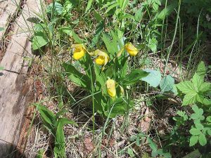
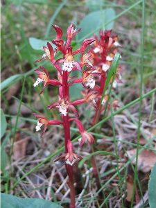
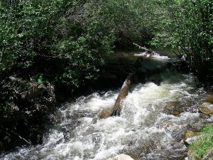
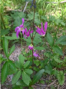
Wildflowers including Yellow Ladyslippers and Shooting Stars; lush forest; trout stream; caves.
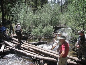
CautionsStream crossings (on logs or wade). Hiking poles recommended.
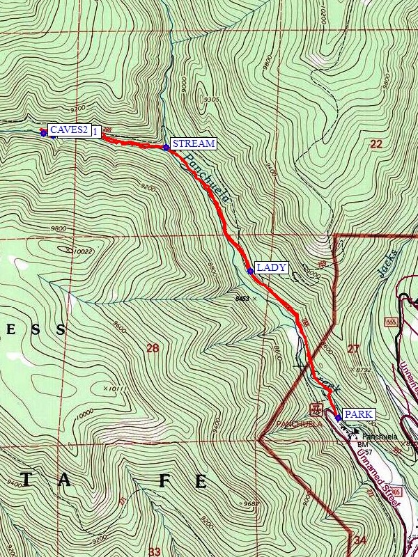
Trailhead DirectionsI-25 north past Santa Fe. Take Glorieta Exit 299 and follow SR 50 to the town of Pecos. There is a gas station in Pecos for a rest stop, or you can go to the ranger station in Cowles about 1/4 miles to the right (south) on SR 63. Or just go left and follow SR 63 north to Cowles. At sign (“Panchuela C. G.”) turn left, then take right fork onto one-lane road about one mile north past Pino Ranch to Panchuela C.G. and PARK (0.0 mi).
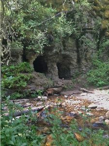
Actual HikeCross to right (north) side of Panchuela Creek at the campground (on a bridge). Follow Cave Creek Trail 288 up the creek. If you’re here in June, look for yellow lady slippers on both sides of the trail, especially at LADY (0.9 mi). Cross Panchuela Creek on logs at STREAM (1.7 mi) and follow the left fork on the right (north) side of Cave Creek. The caves start about 1/2 mile upstream from the stream crossing. Look for paths off to the left which go to the caves (CAVES1 (2.2 mi) and CAVES2 (2.6 mi)). Have lunch at CAVES2 and return the same way.
CommentsAfter the caves, the trail continues up the canyon, following the north bank of the river. The canyon is beautifully wooded and abounds in wildflowers including spectacular yellow lady slippers, iris, shooting stars, and roses. Go in June for the lady slipper and shooting stars. Bird calls are unique. Driving there is half the fun. The drive along the Pecos River features a monastery, Monastery Lake, Tres Lagunas subdivision and other fine second homes, tailings from a turquoise mine and a quaint country store in Terrero that has a dramatic stuffed cougar and hummingbirds galore.
WaypointsPARK: N35 49.790, W105 39.843
LADY: N35 50.410 W105 40.297
STREAM: N35 50.932, W105 40.733
CAVES1: N35 50.983, W105 41.315
CAVES2: N35 50.991, W105 41.367
Hike GPS File Name: CaveCreekWayTrackRev1_MWMW.gpx
Hike GPS File: Click link to download hike waytrack file
Text Author: Roger Holloway
Map Author: Marilyn Warrant
Waypoints Author: Marilyn Warrant
Track Author: Marilyn Warrant
Maintainer: Marilyn Warrant
Editor: Howard Carr