Continental Divide North Hike
In Cabezon Region
Map File Source: NG Topo
 Hike Key: H10033
Last Updated: 12/15/2020 12:00am
Last Updated By: Marilyn Warrant
Hike Class: B (Moderate)
Hike Distance: 4.5 mi
Minimum Elevation: 6360 ft
Elevation Change: 265 ft
Total Uphill: 540 ft
Total Downhill: 540 ft
Avg. Grade: 5 %
Route Type: InOut
On Trail: Yes
Paved or Gravel Roads: Yes
GPS Advised: No
Drive Distance Round Trip: 145 mi
Drive Time One-Way: 1:30
Hiking Seasons: Spring, Fall, and Winter
New Mexico Game Unit: 7
Hike Status: Published
Access Description: Cabezon Area Access
Highlights
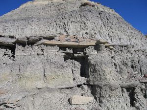
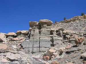
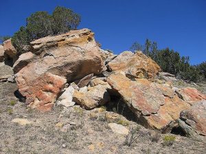
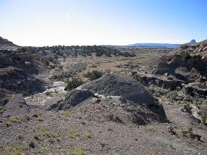
Spectacular views of the Rio Puerco Valley, Cabezon Peak and many other cinder cones and volcanic plugs. Various shapes and colors in the sandstone bluffs.
CautionsNone.
Trailhead DirectionsFrom Albuquerque take I-25 north to Bernalillo. Take US 550 to San Ysidro. Drive west 18 mi. past intersection of SR 4 and US 550 to San Luiz Rd. Turn left and drive 8.5 miles to Torreon Rd. Turn right onto TORREON RD and drive 3.6 miles to a cattle guard at the top of a hill. Turn right over a yellow cattle guard onto dirt road, pull off, and PARK (0.0 mi).
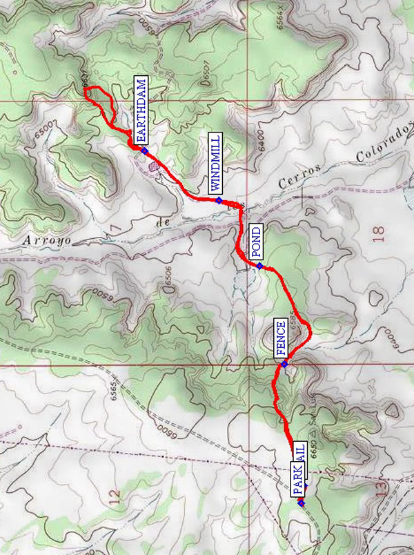
Actual HikeThe Continental Divide Trail crosses Torreon Road just east of parking. Locate the first cairn marking the TRAIL (0.1 mi) along a dirt road that goes off at an angle to the northeast. The trail is well marked on mostly rocky terrain with sandy patches along a mostly northerly track. The trail goes up and down along the mesa’s southeast rim. The trail is also marked with metal plates on tree trunks and the initials CD and an arrow punched into the metal. Continue following the cairns past a FENCE (0.6 mi), a POND (1.1 mi), a WINDMILL (1.4 mi), and an EARTHDAM (1.8 mi) and climb up onto a high mesa with wonderful 360 degree views for lunch.
CommentsSpectacular views of the Rio Puerco Valley, Cabezon Peak and many other cinder cones and volcanic plugs. The sandstone bluffs contain intense reds and you’ll find odd egg-shell forms and hollows in them. Twisted juniper trees abound.
WaypointsTORREON RD: N 35 40.177, W 107 03.665
PARK: N 35 42.508, W 107 06.280
TRAIL: N 35 42.498, W 107 06.207
FENCE: N 35 42.562, W 107 05.714
POND: N 35 42.644, W 107 05.315
WINDMILL: N 35 42.778, W 107 05.050
EARTHDAM: N 35 43.025, W 107 04.847
Hike GPS File Name: ContinentalDivideNorthWayTrack_JBMW.gpx
Hike GPS File: Click link to download hike waytrack file
Text Author: Roger Holloway
Map Author: Marilyn Warrant
Waypoints Author: Marilyn Warrant
Track Author: John Boyd
Maintainer: Marilyn Warrant
Editor: Howard Carr