San Antonio Hot Spring – South Route Hike
In Jemez Mountains Region
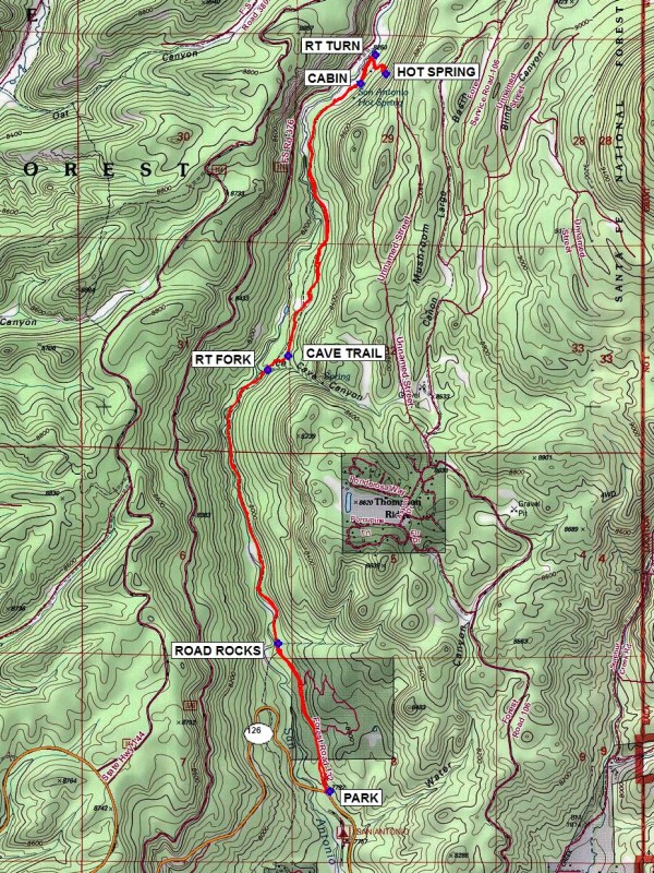
Map File Source: NG Topo
 Hike Key: H10491
Last Updated: 03/06/2021 12:00am
Last Updated By: Marilyn Fixer
Hike Class: C (Challenging)
Hike Distance: 8.9 mi
Minimum Elevation: 7728 ft
Elevation Change: 617 ft
Total Uphill: 895 ft
Total Downhill: 895 ft
Avg. Grade: 7 %
Route Type: InOut
On Trail: Yes
Paved or Gravel Roads: Yes
GPS Advised: Yes
Drive Distance Round Trip: 150 mi
Drive Time One-Way: 1:30
Hiking Seasons: Spring, Summer, and Fall
New Mexico Game Unit: 6A
Hike Status: Published
Highlights
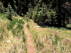
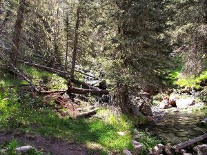
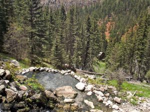
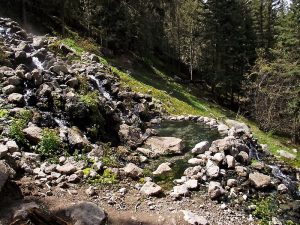
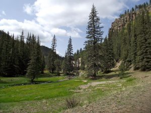
Follow a pleasant tree-lined trail beside San Antonio Creek. Then climb to the hot springs through a lush wildflower meadow.
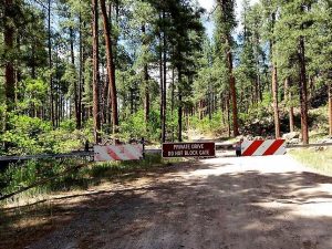
CautionsHiking sticks and bathing suits recommended. This hike goes along FR-132 crossing private property (darker green on the map). Stay on the road from PARK to ROAD ROCKS waypoints to avoid trespassing.
Trailhead DirectionsFrom Albuquerque take I-25 north to Bernalillo. From Bernalillo take US 550 west to San Ysidro. Take SR 4 north to La Cueva. Turn left (west) on SR 126. Follow SR 126 for 1.8 miles. Turn right, cross the cattle guard and park along the fence line to the right. Please be sure not to block the road, the gate, or other cars when you park. The hike begins to the north on the road with the gate across it.
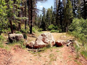
Actual HikeFrom PARK (0.0 mi) go north on the dirt road (not west on the trail) toward waypoint ROAD ROCKS. This dirt road is on private property and the landowners currently allow hikers to walk only on the road, so hikers must stay on this road. Please respect their private property, buildings, and vehicles along this road so that we may continue to have this access to the San Antonio canyon. Once reaching ROAD ROCKS (0.8 mi) the private land ends and you are on USFS land. Continue north on the old road and just past the end of this road, take the trail at RT FORK (2.4 mi). Go north past the trail to the ice cave at CAVE TRAIL (2.5 mi). Continue north on the trail to the first CABIN (4.2 mi) and fork to the left down the dirt road. Make a RT TURN (4.3 mi), and follow the winding uphill trail to the HOT SPRINGS (4.5 mi). Back track out the way you came in.
CommentsThis is a fantastically beautiful hike especially in the spring when there are acres of wildflowers in full bloom. Most of the time the hike is in the shade and is above San Antonio Creek. Large fish have been seen on occasion.
On 6/18/13 we descended from the hot springs along the north side, turning south just before reaching the creek. This return route added 0.25 mile to the hike.
The feed store/general store in San Ysidro has an extensive trophy room in the back room which is worth stopping for.
WaypointsPARK: N35 53.404, W106 38.889
ROAD ROCKS: N35 54.019, W106 39.152
RT FORK: N35 55.158, W106 39.207
CAVE TRAIL: N35 55.216, W106 39.100
CABIN: N35 56.347, W106 38.730
RT TURN: N35 56.468, W106 38.657
HOT SPRING: N35 56.389, W106 38.602
Hike GPS File Name: SanAntonioHotSprings-SouthRouteWayTrackRev_FE-1.gpx
Hike GPS File: Click link to download hike waytrack file
Text Author: Frank Ernst
Map Author: Marilyn Warrant
Waypoints Author: Frank Ernst
Track Author: Frank Ernst
Maintainer: Not Assigned
Editor: Marilyn Warrant