Oat – Hay Canyons Loop Hike
In Jemez Mountains Region
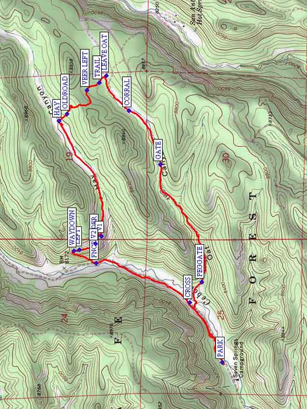
Map File Source: NG Topo
 Hike Key: H10087
Last Updated: 12/15/2020 12:00am
Last Updated By: Marilyn Warrant
Hike Class: C (Challenging)
Hike Distance: 5.4 mi
Minimum Elevation: 8074 ft
Elevation Change: 715 ft
Total Uphill: 918 ft
Total Downhill: 918 ft
Avg. Grade: 9 %
Route Type: Loop
Protected: Yes
On Trail: No
Paved or Gravel Roads: No
GPS Advised: Yes
Drive Distance Round Trip: 160 mi
Drive Time One-Way: 1:45
Hiking Seasons: Spring, Summer, and Fall
New Mexico Game Unit: 6A
Hike Status: Inactive
Highlights
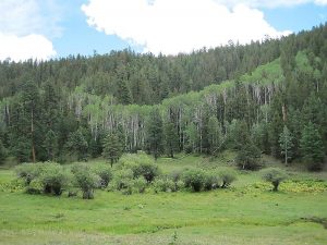
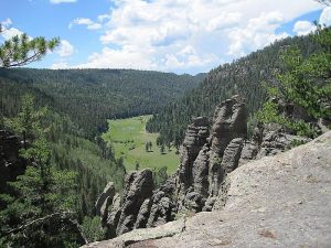
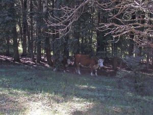
Overlooks; towering spire; cave; green valley with wildflowers.
CautionsSteep narrow downhill animal trail. Hiking poles recommended.
Trailhead Directions
North on I-25 to exit 242 (Bernalillo), west on US 550 to San Ysidro. North on SR 4 to La Cueva. Take SR 126 west about 9 mi. to Fenton Lake, keep going north 4 mi. until you come to the [HATCHGATE] with the Fish Hatchery off to the right. Continue through the gate a very slow mile or so until you come to a fence and corral and PARK (0.0 mi) there.
Actual Hike
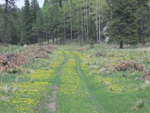
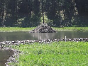
Hike from the campground, CROSS (0.4 mi) the stream, and enter Oat Canyon through a PEGGATE (0.6 mi). The road is quite deteriorated between this and GATE (1.6 mi), but the hike is wonderful. After the second gate the road is very good. You’ll go by a CORRAL (2.0 mi) on the right. After that, you will come to a place where another (minor) road veers off to the right. A little ways beyond that, look for a big stump on the right and a power pole with the lower set of wires tied off. Here, turn left and LEAVE OAT (2.3 mi). Go into the little meadow, keeping the trees to your immediate left, and you’ll shortly find a game TRAIL (2.4 mi). VEER LEFT (2.4 mi) to go over the saddle and follow game trails until you find the OLDROAD (2.8 mi), which leads to the lovely valley of HAY (2.9 mi) Canyon. You may want to have a partial lunch here. Follow Hay Canyon down (left – west) until it brings you to a tremendous towering spire of rock. There is a cave there, too, carved out of soft volcanic ash from overflowing waters. Have the rest of your lunch at one of the overlooks of the Cebolla (Onion) River and beaver pond far below at V1 (3.8 mi) or V2 (3.9 mi). Continue north along the bluffs, staying to the LEFT (4.0 mi), and at WAYDOWN (4.0 mi) follow the narrow, steep trail down diagonally to the valley below. Take your time, and step sideways if necessary to keep from falling. Cross the fence at FNCE-UNDER (4.2 mi) a short distance left following the fence, and let your rubbery legs recover. You’ll need to cross the stream one more time as you return south to the van.
Comments
Check ahead to verify that the gate at the Fish Hatchery to the day-use “campground” is open. You can call the hatchery at 1-575-829-3740 to inquire. In previous years, the gate has remained closed until Memorial Day. Bring your hiking sticks for stability on the way down from Hay Canyon and for crossing the stream.
Hike has been replaced by the Oat-Hay Canyons to Bottom hikes, which have a safer way to descend from Hay to Cebolla Creek.
WaypointsHATCHGATE: N35 55.684, W106 42.100
PARK: N35 56.144, W106 40.996
CROSS: N35 56.295, W106 40.636
PEGGATE: N35 56.253, W106 40.457
GATE: N35 56.481, W106 39.668
CORRAL: N35 56.650, W106 39.308
LEAVE OAT: N35 56.775, W106 39.074
TRAIL: N35 56.813, W106 39.120
VEER LEFT: N35 56.880, W106 39.172
OLDROAD: N35 56.989, W106 39.328
HAY: N35 57.033, W106 39.378
V1: N35 56.801, W106 40.150
V2: N35 56.831, W106 40.199
LEFT: N35 56.921, W106 40.241
WAYDOWN: N35 56.951, W106 40.245
FNCE-UNDER: N35 56.830, W106 40.331
Hike GPS File Name: Oat-HayCanyonsLoopWayTrack_MWMW.gpx
Hike GPS File: Click link to download hike waytrack file
Text Author: Roger Holloway
Map Author: Marilyn Warrant
Waypoints Author: Marilyn Warrant
Track Author: Marilyn Warrant
Maintainer: Marilyn Warrant
Editor: Marilyn Warrant