Mesa Prieta Hike
In Albuquerque Region
Map File Source: NG Topo
 Hike Key: H10340
Last Updated: 12/15/2020 12:00am
Last Updated By: Marilyn Warrant
Hike Class: B (Moderate)
Hike Distance: 3.8 mi
Minimum Elevation: 5300 ft
Elevation Change: 212 ft
Total Uphill: 347 ft
Total Downhill: 347 ft
Avg. Grade: 4 %
Route Type: Loop
On Trail: No
Paved or Gravel Roads: Yes
GPS Advised: Yes
Drive Distance Round Trip: 20 mi
Drive Time One-Way: 0:15
Hiking Seasons: Spring, Fall, and Winter
New Mexico Game Unit: 9
Hike Status: Published
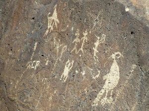
Highlights
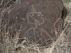
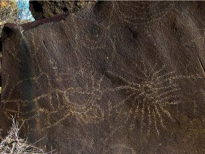
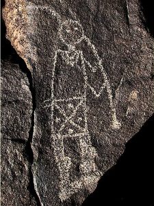
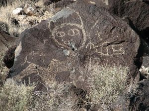
Explore the south portion of the escarpment in Petroglyph National Monument and enjoy petroglyphs few visitors see.
CautionsWalking in sand.
Trailhead Directions
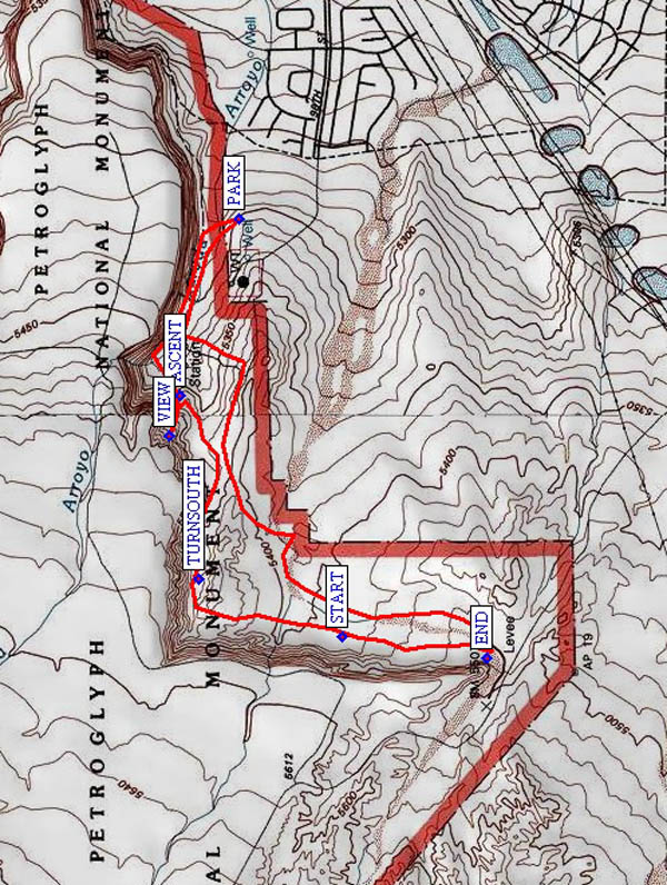
Take I-40 west to Exit 154, Unser Boulevard, north. Turn left at Tierra Pintado and continue until you see the development called Petroglyphs. Turn right into the development and continue to the end of the road. Turn left and PARK (0.0 mi) at the dead end near the water tower.
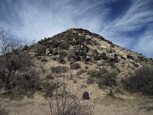
Actual Hike
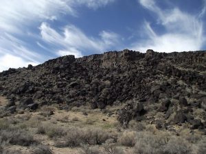
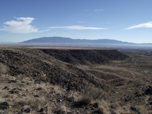
Head into the park by walking toward the volcanic escarpment. Crawl under the park fence and once near the escarpment locate a trail that follows along to the west (turn left). After about 1/2 mile (ASCENT (0.5 mi)), a side trail climbs up onto the top of the escarpment for an interesting VIEW (0.7 mi). Climb back down, then proceed west until the escarpment angles sharply south, where you TURNSOUTH (1.2 mi), too. The rock face is quite high along this southernmost part of the escarpment and much more like cap rock than in other parts of the park. Of course there are petroglyphs on the rock to see as well, from START (1.7 mi) to END (2.1 mi), including a wonderful image we at the park call Mr. Knobby Knees. The southern end of the escarpment is a good place for lunch. Return by following an arroyo, then cut across open park land to the hike start point.
Waypoints
PARK: N 35 06.794, W 106 44.512
ASCENT: N 35 06.922, W 106 44.984
VIEW: N 35 06.946, W 106 45.090
TURNSOUTH: N 35 06.881, W 106 45.473
START: N 35 06.569, W 106 45.625
END: N 35 06.250, W 106 45.685
Hike GPS File Name: MesaPrietaWayTrack_WHWH.gpx
Hike GPS File: Click link to download hike waytrack file
Text Author: Judie Schwartz
Map Author: Marilyn Warrant
Waypoints Author: Bill Hansen
Track Author: Bill Hansen
Maintainer: Dawn McIntyre
Editor: Marilyn Warrant