Gypsum Slot Canyon Via River Crossing Hike
In San Ysidro Region
Map File Source: DeLorme
 Hike Key: H10339
Last Updated: 12/15/2020 12:00am
Last Updated By: Marilyn Warrant
Hike Class: B (Moderate)
Hike Distance: 5.6 mi
Minimum Elevation: 5515 ft
Elevation Change: 429 ft
Total Uphill: 490 ft
Total Downhill: 490 ft
Avg. Grade: 4 %
Route Type: CCW Loop
Protected: Yes
On Trail: No
Paved or Gravel Roads: Yes
GPS Advised: Yes
Drive Distance Round Trip: 90 mi
Drive Time One-Way: 1:00
Hiking Seasons: Spring, Fall, and Winter
New Mexico Game Unit: 6A
Hike Status: Published
Highlights
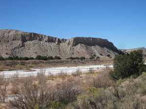
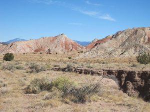
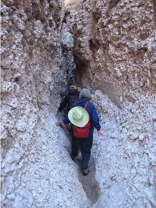
Spectacular scenery of brightly colored cliffs and views in all directions. Short trip through a very narrow slot canyon that has been carved through white gypsum deposits.
CautionsCross the Rio Penasco on boards.
Trailhead Directions
North on I-25, west on US 550 from Bernalillo to near milepost 27 which is about 3.5 miles past the SR 4 turnoff in San Ysidro. PARK (0.0 mi) on the eastbound lane shoulder.
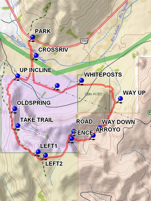
Actual Hike
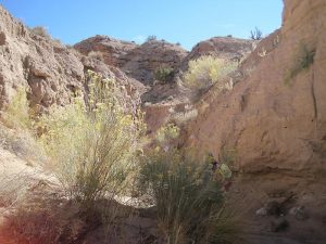
Go through/over the roadside fence, head south, and cross the Rio Salado at CROSSRIV (0.2 mi) or other convenient location. Boards will be used to prevent sinking into the soft river sand. Continue south to a dirt road and then go to the north end of the TA Anticline. Ascend the TA Anticline at UP INCLINE (0.7 mi), pass numerous mineral springs and find a bike trail (TAKE TRAIL (1.5 mi)) that leads to the south, then to the southeast, and eventually to the bike trails or old roads that lead to the east, toward the gypsum mine. Take a couple of left turns (LEFT1 (1.9 mi) and LEFT2 (2.1 mi)), cross the FENCE (2.6 mi), and find the steep dirt ROAD (2.6 mi) that descends into the valley to the east. At the bottom, go down an ARROYO (2.9 mi) to the north that leads to the slot canyon (scrambling at WAY DOWN (3.1 mi)) is required to get from the first arroyo to the slot canyon arroyo). Depending on the season you may encounter mud, tumbleweeds, and in winter, snow or ice. The actual gypsum slot is about one hundred yards long, very narrow but always open above you. You will encounter a log wedged part way through the slot that may be a struggle to pass, bout one quarter mile. After exiting the slot, find a slope on your left (WAY UP (3.7 mi)) that you can scramble up and out of the arroyo. Hike cross-country around the corner on your left to a lunch spot. After lunch, head west for a fence with a gate near the YELLOW (4.8 mi)-painted posts that were installed as a pipeline markers. Head for the Rio Salado crossing (CROSSRIV) used at the start of the hike and use the boards again to the river. The van will be in view.
Comments
This hike used to be called Rio Salado Slot – T.A. Anticline.
WaypointsPARK: N 35 32.626, W 106 50.581
CROSSRIV: N 35 32.417, W 106 50.536
UP INCLINE: N 35 32.188, W 106 50.791
OLDSPRING: N 35 31.818, W 106 50.829
TAKE TRAIL: N 35 31.626, W 106 50.786
LEFT1: N 35 31.333, W 106 50.506
LEFT2: N 35 31.292, W 106 50.405
FENCE: N 35 31.483, W 106 50.041
ROAD: N 35 31.563, W 106 50.015
ARROYO: N 35 31.518, W 106 49.745
WAY DOWN: N 35 31.602, W 106 49.657
WAY UP: N 35 31.932, W 106 49.367
WHITEPOSTS: N 35 32.136, W 106 49.905
YELLOW: N 35 32.078, W 106 50.244
Hike GPS File Name: GypsumSlotCanyonViaRiverCrossingWayTrack_MWMW.gpx
Hike GPS File: Click link to download hike waytrack file
Text Author: John Holmes
Map Author: Marilyn Warrant
Waypoints Author: Marilyn Warrant
Track Author: Marilyn Warrant
Maintainer: Bill Gloyd
Editor: Marilyn Warrant