Faulty Trail – End to End Hike
In Sandia Mountain East Region
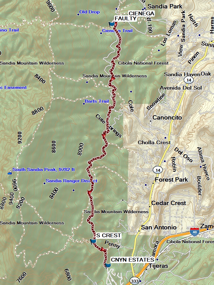
Map File Source: Garmin BaseCamp
 Hike Key: H10694
Last Updated: 01/26/2024 8:33pm
Last Updated By: Dawn McIntyre
Hike Class: C (Challenging)
Hike Distance: 7.9 mi
Minimum Elevation: 6580 ft
Elevation Change: 1300 ft
Total Uphill: 1380 ft
Total Downhill: 2000 ft
Avg. Grade: 8 %
Route Type: Oneway
On Trail: Yes
Paved or Gravel Roads: Yes
GPS Advised: Yes
Hiker Limit (NF/BLM/NP): 15 (Sandia Wilderness)
Drive Distance Round Trip: 50 mi
Drive Time One-Way: 0:45
Hiking Seasons: Spring, Summer, and Fall
New Mexico Game Unit: 8
Hike Status: In Process
Highlights
Up to 28 Medallion Trees.
CautionsNone.
Trailhead Directions
To leave from the Cienega TH: From Albuquerque take I-40 east to Tijeras exit 175. North on SR 14. Left on Sandia Crest Scenic Byway (SR 536). Watch for signs. Cienega Canyon and Sulfur Canyon will be on your left, just after milepost 1. Almost immediately there is a fork to the left (south to Cienega Trailhead). Take that road over the hill to the T intersection and go right. The parking area and trailhead are at the end of the road.
Comments
The track was assembled from tracks posted on Mike Coltrin’s website.
WaypointsPARK-CIENEGA: N35 10.181, W106 23.045
FAULTY: N35 10.082, W106 23.384
S CREST: N35 05.858, W106 23.834
CNYN ESTATES: N35 05.388, W106 23.475
Hike GPS File Name: FaultyEndToEndWayTrack_MW.gpx
Hike GPS File: Click link to download hike waytrack file
Text Author: Carl Gervais
Map Author: Marilyn Warrant
Waypoints Author: Marilyn Warrant
Track Author: Mike Coltrin
Maintainer: Carl Gervais
Editor: Dawn McIntyre