Bosque Peak – Crest – Trail Canyon Hike
In Manzano Mountains East Region
Map File Source: NG Topo
 Hike Key: H10389
Last Updated: 12/15/2020 12:00am
Last Updated By: Marilyn Warrant
Hike Class: D (Difficult)
Hike Distance: 7.5 mi
Minimum Elevation: 7536 ft
Elevation Change: 1995 ft
Total Uphill: 1680 ft
Total Downhill: 2209 ft
Avg. Grade: 10 %
Route Type: Oneway
On Trail: No
Paved or Gravel Roads: No
GPS Advised: Yes
Drive Distance Round Trip: 125 mi
Drive Time One-Way: 1:45
Hiking Seasons: Summer and Fall
New Mexico Game Unit: 14
Hike Status: Published
Highlights
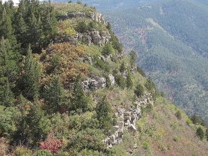
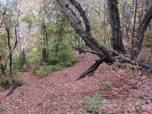
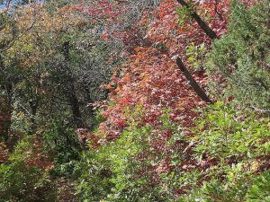
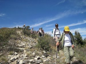
Hike part of the Manzano Crest Trail with 360 views from the ridge. Beautiful yellow & red leaves in the fall.
CautionsHiking poles recommended for the downhill return.
Trailhead Directions
I-40 east to Tijeras exit 175. South on 337 (14) to its end (mile 0). West on SR 55 to Tajique. In Tajique, after Ray’s Gas Station (on right) is a cemetery. Turn right at end of cemetery onto Fourth of July Rd (FR 55). Take FR 55 about 7 miles to 4th of July CG turnoff and continue south (road becomes primitive dirt) for about 2.3 mi. to trailhead for Trail 174. There are two places to park. Go past the first one and PARK (0.0 mi) at the second one because it has toilets and picnic tables. Drop off the hikers, and drive the van and shuttle vehicle further south to the next trailhead TRAIL CNYN. Drive one of the vehicles back to the Bosque Peak trailhead. If you can’t do the shuttle, add another 2 mi to the hike distance to walk back to the Bosque Peak TH.
Actual Hike
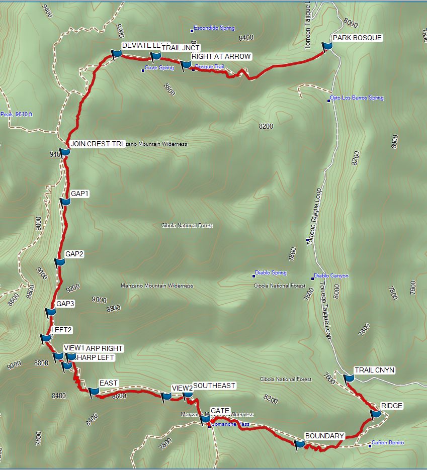
Hike up the Bosque Peak Trail (174), taking the old trail straight ahead just after the fir tree at TRAIL JNCT (1.4 mi). Continue up to a meadow with a STONE ARROW (2.0 mi) on the ground. Follow the arrow south on a faint trail that goes to the top of the ridge. Have lunch somewhere in the trees. When you get out of the trees look around for a rock cairn marking the CREST TRAIL (2.9 mi).
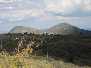
The key to hiking this part of the Crest Trail is to be sure you see a rock cairn or colorful flagging tape on a tree ahead of you. From where you join the CREST TRAIL go south until you veer to the left at LEFT1 (3.0 mi). From the next cairn, go south alternating open areas with thickets (if you can’t find the trail in a thicket, go to the next cairn following the gap at GAP1 (3.5 mi), GAP2 (3.9 mi) or GAP3 (4.2 mi)). At LEFT2 (4.4 mi), the trail steepens and starts going generally southeast. Enjoy the almost 360 degree VIEW1 (4.5 mi). Take a SHARP RIGHT (4.6 mi) then a SHARP LEFT (4.6 mi). The trail then goes EAST (5.0 mi), passes a VIEW2 (5.5 mi) of Comanche Canyon, then goes SOUTHEAST (5.6 mi) again. Some of this part is on the edge of the western side of the ridge. Go through the GATE (5.9 mi), where you may find some old trail signs to Comanche Trail. This is the beginning of the Trail Canyon Trail, which goes generally east to the wilderness BOUNDARY (6.5 mi), then northeast up a little RIDGE (7.2 mi), then northwest to the TRAIL CNYN (7.4 mi) trailhead.
Comments
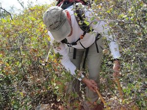
The primitive road between the Bosque Peak and Trail Canyon trailheads is all dirt, and can be impassable when wet, so take care if there has been recent precipitation or the forecast for the hike day looks bad. A thaw can be just as bad as rain. A load of gravel might do a world of good. Use a high clearance shuttle vehicle. Not a hike for windy days, either. This part of the Manzano Crest Trail has some sections of open rocky ground with cairns, some sections of oak thickets, and a few good trail stretches in the woods. Several hikers should bring loppers, hedge clippers, or a machete unless you know that the trail has been cleared in the past year or two. The elevation change is measured from the Bosque Peak trailhead, which is higher than the Trail Canyon trailhead. The actual maximum elevation is 9550 ft.
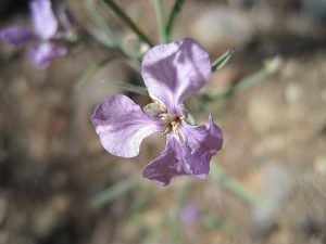
This is a beautiful hike, especially in the fall. This part of the Manzanos is known for its maples, which turn beautiful shades of red & orange.
WaypointsPARK: N34 46.297, W106 23.525
TRAIL JNCT: N34 46.247, W106 24.631
STONE ARROW: N34 46.188, W106 25.180
CREST TRAIL: N34 45.911, W106 25.321
LEFT1: N34 45.811, W106 25.316
GAP1: N34 45.491, W106 25.216
GAP2: N34 45.178, W106 25.251
GAP3: N34 44.923, W106 25.310
LEFT2: N34 44.785, W106 25.339
VIEW1: N34 44.693, W106 25.259
SHARP LEFT: N34 44.643, W106 25.205
SHARP RIGHT: N34 44.690, W106 25.177
EAST: N34 44.511, W106 25.030
VIEW2: N34 44.484, W106 24.563
SOUTHEAST: N34 44.498, W106 24.427
GATE: N34 44.367, W106 24.311
BOUNDARY: N34 44.238, W106 23.703
RIDGE: N34 44.394, W106 23.213
TRAIL CNYN: N34 44.577, W106 23.386
Hike GPS File Name: BosquePeak-Crest-TrailCanyon.jpg
Hike GPS File: Click link to download hike waytrack file
Text Author: Marilyn Warrant
Map Author: Marilyn Warrant
Waypoints Author: Marilyn Warrant
Track Author: Marilyn Warrant
Maintainer: Marilyn Warrant
Editor: Howard Carr