Arroyo Piedra Lumbre Central Hike
In Cabezon Region
Map File Source: DeLorme
 Hike Key: H10550
Last Updated: 12/05/2023 6:39pm
Last Updated By: Marilyn Fixer
Hike Class: B (Moderate)
Hike Distance: 4.1 mi
Minimum Elevation: 6235 ft
Elevation Change: 155 ft
Total Uphill: 180 ft
Total Downhill: 180 ft
Avg. Grade: 3 %
Route Type: CCW Loop
Protected: Yes
On Trail: No
Paved or Gravel Roads: No
GPS Advised: Yes
Drive Distance Round Trip: 150 mi
Drive Time One-Way: 1:45
Hiking Seasons: Spring, Fall, and Winter
New Mexico Game Unit: 9
Hike Status: Published
Highlights
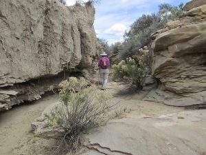
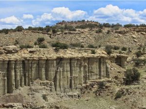
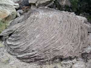
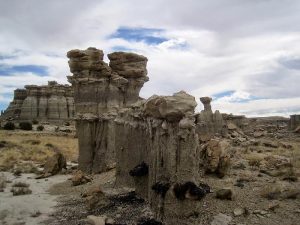
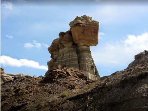
Lots of formations and interesting cliffs on this wandering hike.
CautionsThe hike is off trail. Poles may be useful.
Trailhead Directions
From Albuquerque take I-25 north to Bernalillo. Take US 550 to San Ysidro. Drive west 18 mi. past intersection of SR 4 and US 550 to San Luis Rd.. Turn left and drive 8.5 miles to Torreon Road just after a cattle guard, where the road turns to dirt. Turn right onto paved Torreon Rd (SR 197) and drive 3.6 miles to the top of the rise. TURN LEFT onto a dirt road. Go 4.4 miles to PARK on the right just beyond a small arroyo crossing.
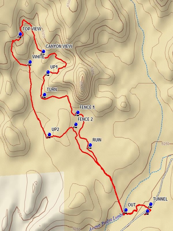
Actual Hike
From PARK (0.0 mi) go back down into the dip in the road and enter the tunnel opening on the left. Hike in the tunnel until you come to the main arroyo. Go up the north side of the ditch and go right and up out OUT (0.3 mi) of the arroyo. Follow the track north until you come to the RUIN (0.7 mi). At this point looking north there will be a variety of formations including the MONOLYTH. Go off the north side of the ridge and follow the track through various formations and up onto a ledge and go around the end of FENCE 1 (1.0 mi). Continue north toward the high cliffs and follow the track to the west to the point where there is a north-going canyon on your right and TURN (1.3 mi) north.
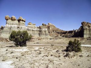
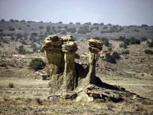
Go right into this canyon and go to UP1 (1.5 mi) where you will climb through a narrow notch to an upper level where you will find a collection of small hoodoos. Follow the track along the ledge to CANYON VIEW (1.9 mi). Take some time to enjoy all of the columns up and down this canyon and the white collection of features on the far side. This is one place where you might relax and have lunch. Then continue north and find a way off of the ledge and go north in the canyon.
The canyon ends. Circle left and upward. Follow the track up onto the next level. The track passes a point on the right. If you wish, climb up onto this point to TOP VIEW (2.3 mi) for great views of the surrounding area and another potential lunch spot.
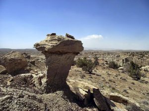
Now the journey back begins. Follow the track down into the end of a second canyon and follow the track which will take you through the WHITE (2.5 mi) formation, then to UP2 (3.0 mi). Go up to the top of the ridge and go along the bottom of the promontory to your left, enjoying the formations ahead until you get to FENCE 2 (3.2 mi). Step over the fence and follow the track back to PARK.
Comments
The use of a GPS for leading this hike is recommended, as this hike is off trail.
WaypointsPARK: N35 42.484, W107 10.499
TUNNEL: N35 42.517, W107 10.478
OUT: N35 42.489, W107 10.644
RUIN: N35 42.808, W107 10.882
FENCE 1: N35 42.967, W107 10.966
UP1: N35 43.164, W107 11.165
CANYON VIEW: N35 43.266, W107 11.195
TOP VIEW: N35 43.351, W107 11.350
UP2: N35 42.859, W107 11.156
FENCE 2: N35 42.909, W107 10.978
Hike GPS File Name: ArroyoPiedraLumbreCentralWayTrack_DBDB.gpx
Hike GPS File: Click link to download hike waytrack file
Text Author: Dick Brown
Map Author: Dick Brown
Waypoints Author: Dick Brown
Track Author: Dick Brown
Maintainer: John Cooper
Editor: Randy Simons