Juan Tabo Cabin Hike
In Sandia Mountain West Region
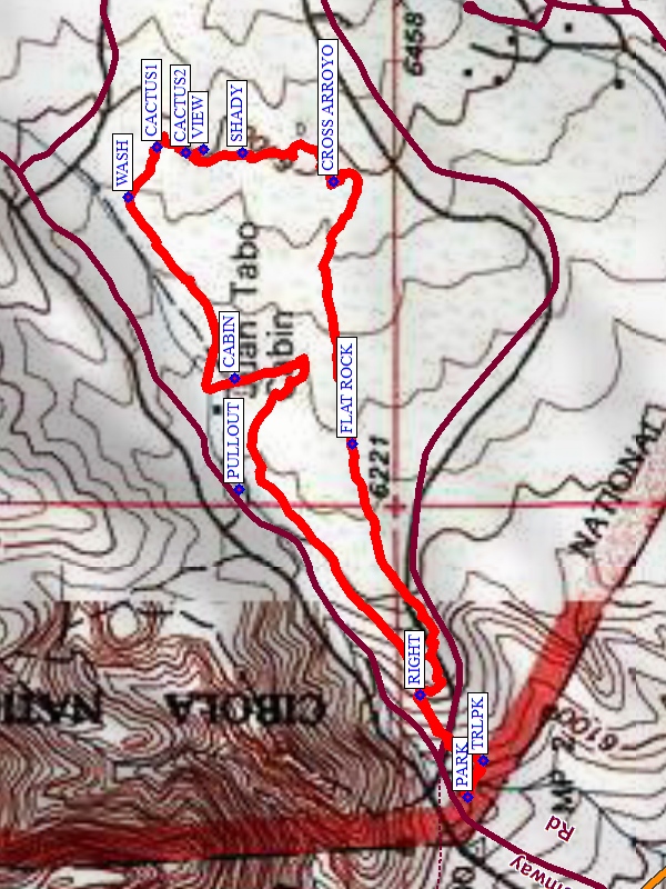
Map File Source: NG Topo
 Hike Key: H10622
Last Updated: 12/05/2023 9:32pm
Last Updated By: Marilyn Fixer
Hike Class: B (Moderate)
Hike Distance: 2 mi
Minimum Elevation: 6100 ft
Elevation Change: 333 ft
Total Uphill: 380 ft
Total Downhill: 380 ft
Avg. Grade: 7 %
Route Type: CCW Loop
On Trail: No
Paved or Gravel Roads: Yes
GPS Advised: Yes
Drive Distance Round Trip: 32 mi
Drive Time One-Way: 0:30
Hiking Seasons: Spring, Summer, Fall, and Winter
New Mexico Game Unit: 8
Hike Status: Published
Highlights
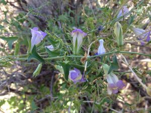
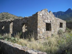
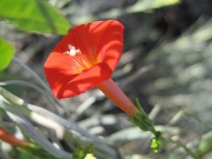
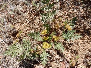
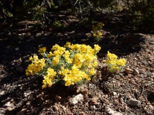
This hike is a short one with variety — flowers in spring, summer, or fall, views of the Sandias, interesting arroyos, and the Juan Tabo Cabin ruins.
CautionsMost of the hike is off-trail in sandy arroyos, on narrow mountain bike trails, or on deer trails.
Trailhead DirectionsIn Albuquerque go north on Tramway Blvd to Forest Hwy 333, the road to the La Luz trailhead. Follow 333 northeast for a short distance and PARK (0.0 mi) at the pay station on the right. A three dollar fee or Golden Age Pass is required to park here.
Actual HikeFrom PARK, go to TRLPK (0.0 mi) and take a left. From there, walk east in the arroyo. In a short distance, turn RIGHT (0.1 mi) and head uphill. You’ll follow sometimes hard to see little trails with mountain bike treads, human footsteps, horse hooves, and occasional deer sign. Go by a FLAT ROCK (0.45 mi). Curve around to go north, then CROSS ARROYO (0.75 mi). Go north through the grasses and junipers (watch out for cactus or snakes). There’s a nice SHADY (0.9 mi) place, then a VIEW (0.9 mi). Try to locate the tiny cacti (CACTUS 1 and 2) (1.0 mi), then intersect the main WASH (1.1 mi). Turn left, and it’s a short distance to the southwest to the CABIN (1.4 mi). Walk south from there to get into another little arroyo, then get back onto the main arroyo to TRLPK (1.9 mi), then up the little hill to PARK.
CommentsThis hike is short and close enough that you can do it on a summer morning.
WaypointsPARK: N35 12.149, W106 30.248
TRLPK: N35 12.136, W106 30.209
RIGHT: N35 12.192, W106 30.139
FLAT ROCK: N35 12.251, W106 29.869
CROSS ARROYO: N35 12.268, W106 29.587
SHADY: N35 12.348, W106 29.556
VIEW: N35 12.383, W106 29.552
CACTUS2: N35 12.398, W106 29.555
CACTUS1: N35 12.424, W106 29.550
WASH: N35 12.449, W106 29.604
CABIN: N35 12.355, W106 29.798
Hike GPS File Name: JuanTaboCabinRevWayTrack_MW.gpx
Hike GPS File: Click link to download hike waytrack file
Text Author: Marilyn Warrant
Map Author: Marilyn Warrant
Waypoints Author: Marilyn Warrant
Track Author: Marilyn Warrant
Maintainer: Marilyn Warrant
Editor: Randy Simons