Ponderosa Mesa Long Hike
In Jemez Mountains Region
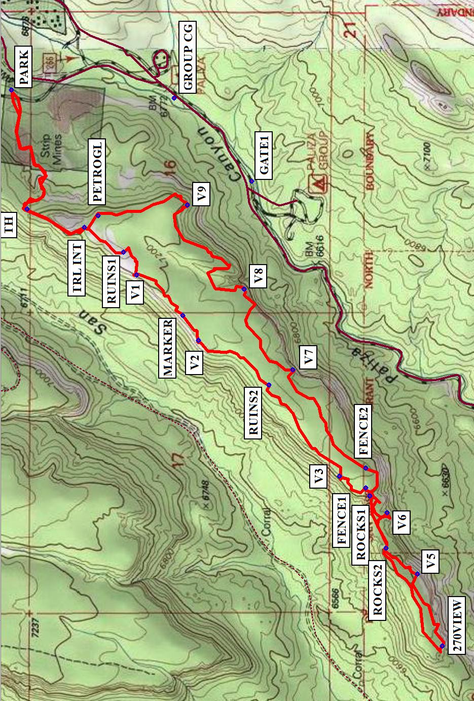
Map File Source: NG Topo
 Hike Key: H10616
Last Updated: 12/15/2020 12:00am
Last Updated By: Marilyn Warrant
Hike Class: C (Challenging)
Hike Distance: 6.5 mi
Minimum Elevation: 6680 ft
Elevation Change: 400 ft
Total Uphill: 1435 ft
Total Downhill: 1435 ft
Avg. Grade: 10 %
Route Type: CCW Loop
On Trail: No
Paved or Gravel Roads: Yes
GPS Advised: Yes
Drive Distance Round Trip: 100 mi
Drive Time One-Way: 1:15
Hiking Seasons: Spring and Fall
New Mexico Game Unit: 6A
Hike Status: Published
Highlights
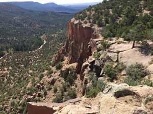
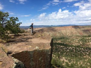
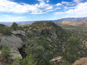
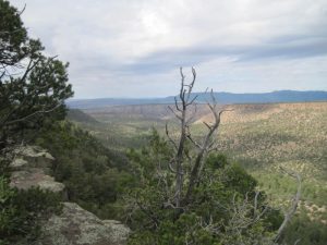
Walk all the way around Ponderosa Mesa, with wonderful views and several ruins. Some alligator junipers and ponderosa pines.
CautionsSteep sections to get up onto the mesa, including a short section of narrow trail with a steep drop-off on one side. Gloves, boots with good traction, and long pants are recommended.
Trailhead DirectionsI-25 north, US 550 west, SR 4 north, SR 290 east past Ponderosa and San Juan Road. After the reservoir on the left, there is a cattleguard, and the pavement changes to gravel. Go past the Paliza Group Campground and GATE1. Stay on FR10, to the left of any road forks. PARK on the right-hand side of the road, opposite the informal camping on the left.
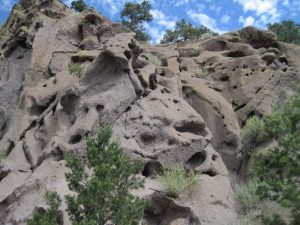
Actual HikeFrom PARK, cross SR 290 to get on an ATV track. It will have short steep sections. The hiking trail itself starts at a vehicle barrier at TH (0.5 mi). Go up the steep narrow trail to reach the mesa at TRL INT (0.8 mi). Take the right-hand (west) option to follow along the San Juan side of the mesa. There are many viewpoints to look down into the valley or over to colorful cliffs to the southwest. The ruins and a survey marker are located along this side — RUINS1 (0.9 mi), MARKER (1.3 mi), and RUINS2 (1.7 mi). Continue until you come to a rusty FENCE1 (2.3 mi). If several hikers press down on the barbed wire, even shorties can cross without tearing their pants. Shortly you’ll come to a narrower finger area where there will be places to walk down or perhaps climb over at ROCKS1 (2.3 mi) and ROCKS2 (2.5 mi) — nothing that difficult, but you might put on your gloves. After that, it’s easy walking over to the 270VIEW (2.9 mi) at the far southwestern end of the mesa. Have lunch on the rocks there. Go back to cross over ROCKS2 (3.4 mi) then ROCKS1 (3.7 mi), then proceed around the eastern side of the mesa. You’ll have to cross over the fence again at FENCE2 (3.9 mi). There are more views on this side, this time down into the town of Ponderosa and the cliffs to the east. Stop at the petroglyphs (PETROGL (5.7 mi)) carved into vertical faces of some of the rock ledges for a rest. Continue to the TRL INT (5.8 mi), then head back down the steep narrow trail to TH (6.0 mi), and follow the ATV track back to the van.
CommentsPlan this hike to be in cooler weather but after mid-April, when the Jemez Ranger Station unlocks the gates. Check with them to verify that the lower gate is open before heading out to do the hike.
WaypointsAccess
GROUP CG N35 42.228 W106 37.712 0.00 ft GROUP CG
GATE1 N35 42.003 W106 38.006 0.00 ft GATE1
Hike
PARK: N35 42.699, W106 37.683
TH: N35 42.653, W106 38.105 (0.5 mi)
TRL INT: N35 42.487, W106 38.170 (0.8 mi)
RUINS1: N35 42.374, W106 38.258 (0.9 mi)
MARKER: N35 42.202, W106 38.483 (1.3 mi)
RUINS2: N35 41.953, W106 38.728 (1.7 mi)
FENCE1: N35 41.672, W106 39.092 (2.3 mi)
ROCKS1: N35 41.661, W106 39.121 (2.3 mi)
ROCKS2: N35 41.614, W106 39.306 (2.5 mi)
270VIEW: N35 41.452, W106 39.653 (2.9 mi)
ROCKS2: N35 41.614, W106 39.306 (3.4 mi)
ROCKS1: N35 41.661, W106 39.121 (3.7 mi)
FENCE2: N35 41.674, W106 39.023 (3.9 mi)
PETROGL: N35 42.448, W106 38.128 (5.7 mi)
TRL INT: N35 42.487, W106 38.170 (5.8 mi)
TH: N35 42.653, W106 38.105 (6.0 mi)
Hike GPS File Name: PonderosaMesaLongWayTrack2_500_MW.gpx
Hike GPS File: Click link to download hike waytrack file
Text Author: Marilyn Warrant
Map Author: Marilyn Warrant
Waypoints Author: Marilyn Warrant
Track Author: Marilyn Warrant
Maintainer: Marilyn Warrant
Editor: Howard Carr