Ghost Ranch – Matrimonial Mesa Loop And Plaza Blanca Hike
In Ghost Ranch Region
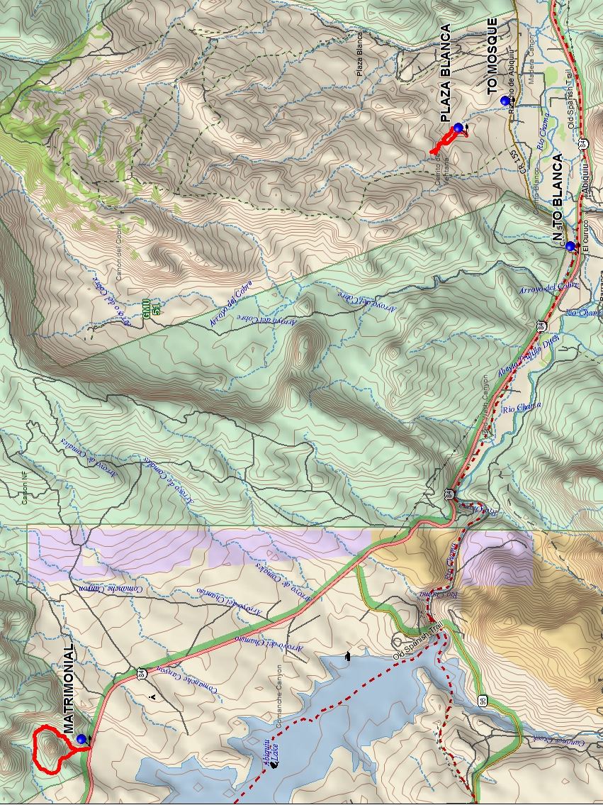
Map File Source: DeLorme
 Hike Key: H10566
Last Updated: 03/12/2021 12:00am
Last Updated By: Marilyn Fixer
Hike Class: C (Challenging)
Hike Distance: 4.1 mi
Minimum Elevation: 6060 ft
Elevation Change: 475 ft
Total Uphill: 790 ft
Total Downhill: 790 ft
Avg. Grade: 8 %
Route Type: Multiple Hikes
On Trail: No
Paved or Gravel Roads: Yes
GPS Advised: Yes
Drive Distance Round Trip: 240 mi
Drive Time One-Way: 2:15
Hiking Seasons: Spring and Fall
New Mexico Game Unit: 51
Hike Status: Published
Cautions
None.
Trailhead DirectionsTrailhead Directions for the individual hikes: the Ghost Ranch – Matrimonial Mesa Loop hike and the Plaza Blanca hike.
Actual HikeActual Hike Descriptions for the individual hikes: Ghost Ranch – Matrimonial Mesa Loop hike and the Plaza Blanca hike.
CommentsAs of March 2021, Ghost Ranch is temporarily closed to hiking due to Covid-19.
Go the Matrimonial hike first then the Plaza Blanca hike. To get to Plaza Blanca on the way back turn left at the waypoint N TO BLANCA: N36 12.574, W106 19.982.
Map Filename: MatrimonialMesa-PlazaBlancaMultiHikeMap.jpgText Author: Dick Brown
Map Author: Marilyn Warrant
Waypoints Author:
Track Author:
Maintainer: Not Assigned
Editor: Howard Carr