Las Huertas North Arroyos Hike
In Placitas Region
Map File Source: NG Topo
 Hike Key: H10547
Last Updated: 03/03/2022 4:09pm
Last Updated By: Howard Carr
Hike Class: B (Moderate)
Hike Distance: 5.2 mi
Minimum Elevation: 5375 ft
Elevation Change: 250 ft
Total Uphill: 615 ft
Total Downhill: 615 ft
Avg. Grade: 6 %
Route Type: CW Loop
On Trail: No
Paved or Gravel Roads: No
GPS Advised: Yes
Drive Distance Round Trip: 60 mi
Drive Time One-Way: 0:45
Hiking Seasons: Spring and Fall
New Mexico Game Unit: 8
Hike Status: Published
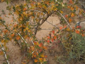
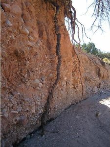
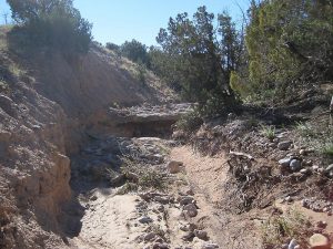
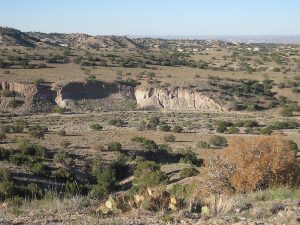
Attractions: Arroyos, Badlands, Views, and Wildflowers
Highlights
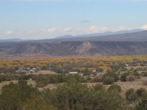
Views of Las Huertas Canyon, the Rio Grande Bosque, and the pueblo sand/gravel operation, flowers in season, and walking in interesting arroyos.
CautionsHiking poles will help on the few steep sections. This hike is mostly off trail (including a steep rocky old road).
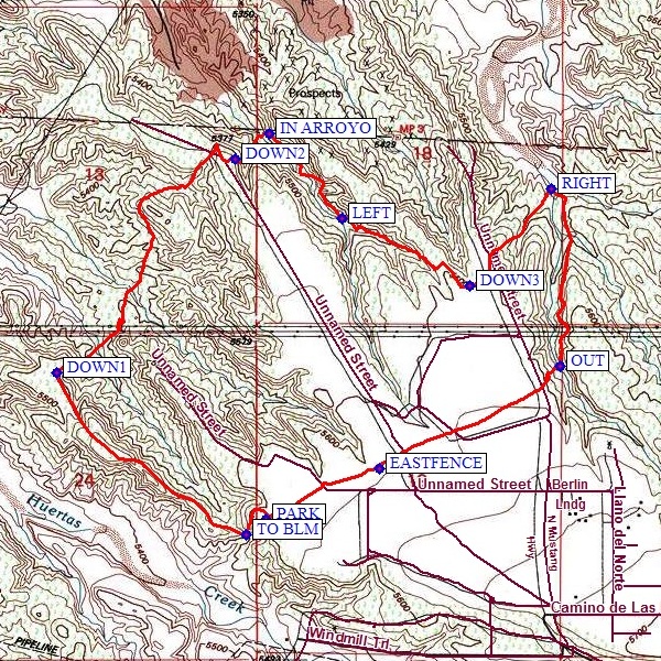
Trailhead DirectionsTake I-25 north to the Bernalillo exit 242. Turn right, and take Hwy 165 east. Pass mile marker 6, the church, and the school. At CAMINO [Camino de las Huertes (green sign on left for Senior Center)], turn left, drive for 2.75 mi to PALOMINO, and turn left. Follow Palomino until it ends at Llano del Norte. Head west and stay on this dirt road, passing Antonito. Make a sharp left turn just before a yellow cattle guard and continue until you see the Open Space sign and a latched pedestrian gate. PARK off to one side of the gate.
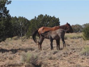
Actual HikeFrom PARK, go through the gate. In a short distance, take the right branch of the trail TO BLM (0.1 mi). Continue along the ridge line, enjoying the views of the Rio Grande Bosque to the northwest. At DOWN1 (0.95 mi), find a way down to the northeast. Go under the big powerlines, into an arroyo, then gradually back up until it’s time to go DOWN2 (2.1 mi) until you are IN ARROYO (2.3 mi). Walk uphill in the arroyo, taking the LEFT (2.7 mi) branch. Take another left at DOWN3 (3.2 mi) and go downhill until you reach another arroyo system, where you’ll take a RIGHT (3.6 mi). Enjoy the rock features and the plants growing in and near the arroyo. At OUT (4.2 mi), exit the arroyo and go steeply uphill a short distance to the mesa. Look for wild horses up here. Head generally southwest to EASTFENCE (4.9 mi), then continue southwest along the fence back to PARK.
CommentsExcept for the very beginning, this hike is on BLM land.
WaypointsCAMINO: N35 18.651 W106 25.236
PALOMINO: N35 20.123 W106 26.680
PARK: N35 20.380, W106 27.628
TO BLM: N35 20.338, W106 27.695 (0.1 mi)
DOWN1: N35 20.772, W106 28.309 (0.95 mi)
DOWN2: N35 21.341, W106 27.728 (2.1 mi)
IN ARROYO: N35 21.407, W106 27.620 (2.3 mi)
LEFT: N35 21.181, W106 27.382 (2.7 mi)
DOWN3: N35 21.001, W106 26.965 (3.2 mi)
RIGHT: N35 21.259, W106 26.701 (3.6 mi)
OUT: N35 20.788, W106 26.672 (4.2 mi)
EASTFENCE: N35 20.516, W106 27.260 (4.9 mi)
Hike GPS File Name: LasHuertasNorthArroyosWayTrackRev2_MW.gpx
Hike GPS File: Click link to download hike waytrack file
Text Author: Marilyn Warrant
Map Author: Marilyn Warrant
Waypoints Author: Marilyn Warrant
Track Author: Marilyn Warrant
Maintainer: Marilyn Warrant
Editor: Howard Carr