Strip Mine South Arroyos & Ridge Loop Hike
In Placitas Region
Map File Source: NG Topo
 Hike Key: H10527
Last Updated: 03/20/2023 2:41pm
Last Updated By: Marilyn Fixer
Hike Class: D (Difficult)
Hike Distance: 5.2 mi
Minimum Elevation: 5904 ft
Elevation Change: 1261 ft
Total Uphill: 1673 ft
Total Downhill: 1673 ft
Avg. Grade: 13 %
Route Type: Messy
On Trail: No
Paved or Gravel Roads: Yes
GPS Advised: Yes
Hiker Limit (NF/BLM/NP): 15 (Sandia Wilderness)
Drive Distance Round Trip: 46 mi
Drive Time One-Way: 1:00
Hiking Seasons: Spring, Fall, and Winter
New Mexico Game Unit: 8
Hike Status: Published
Highlights
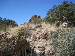
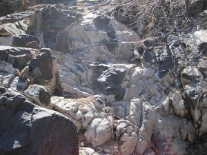
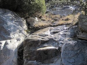
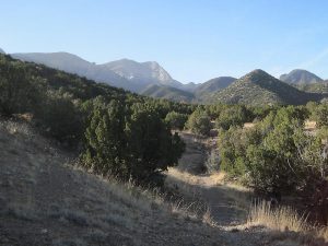
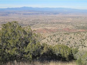
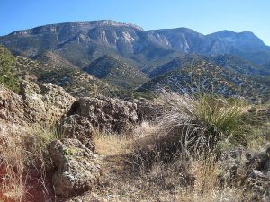
A walk through interesting arroyos to a seep that in the winter is a beautiful mix of ice and rock then follow animal trails along a ridge with views in all directions.
CautionsHiking poles advised for the steep sections (up to 22% grade downhill). There is a fairly long section in the upper part of the main arroyo of rock “steps”.
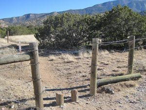
Trailhead DirectionsTake I-25 north to Placitas (exit 242). Go east on SR 165 for 3 miles. Just after the mile 3 marker, turn right and drive about 1 mile until you see a gate in the fence to your left. If you can, park here. There’s a small area at ALT PARK just before PARK, and a bigger area is found at the mouth of the ARROYO.
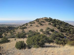
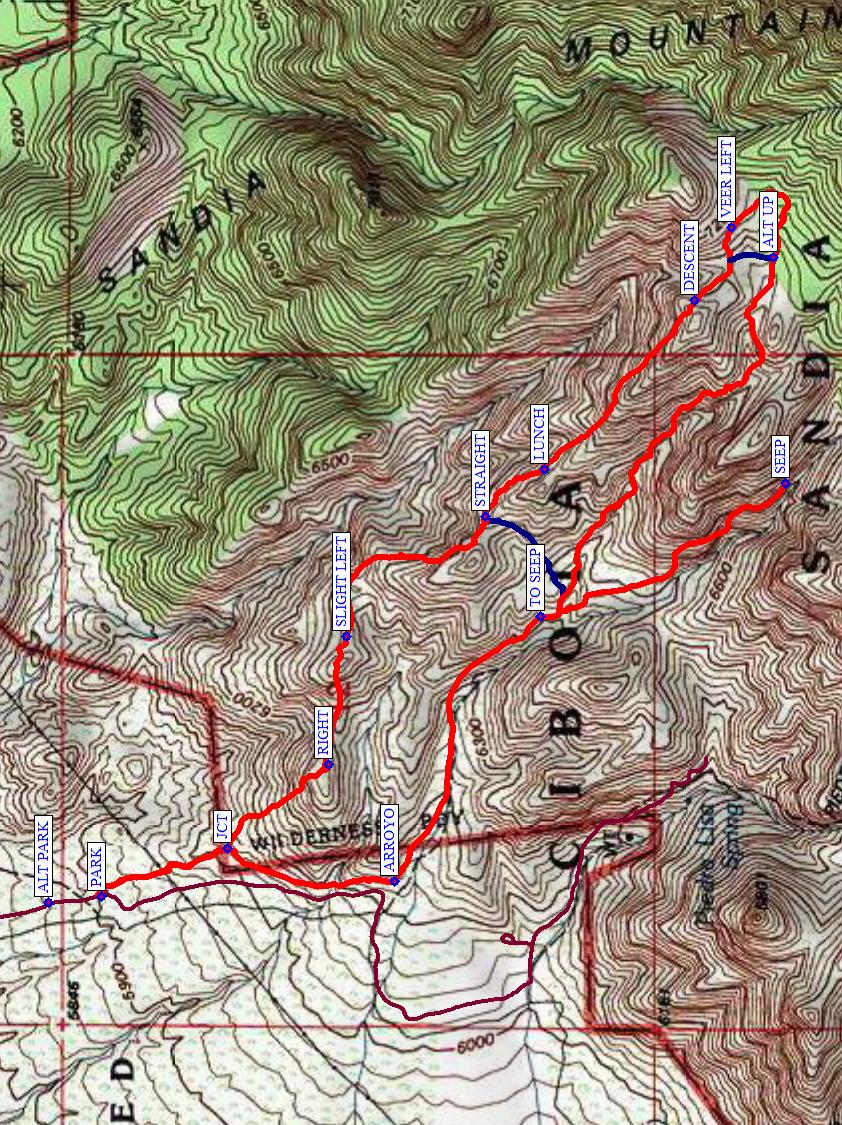
Actual HikeGo through the gate to join the bike trail going south (right). Pass the junction JCT (0.25 mi) with an old road (you’ll hike down the old road on the way back). Turn left (east) into the ARROYO (0.55 mi). Hike up the arroyo to TO SEEP (1.1 mi), which is easy to miss, and veer to the right up the smaller arroyo. The easier way is usually to the east (your left) side of the arroyo. Continue until you come to the SEEP (1.65 mi). Enjoy the view, then return back to the main arroyo. Continue up this arroyo, climbing over rocks to SPLIT (3.2 mi), where you leave the arroyo. Take care to VEER LEFT (3.35 mi) to avoid going on the other side of the ridge. (You might instead try ALT UP (3.1 mi), though it hasn’t been checked out as of spring 2017.) Before you start along the ridge, look down to your right to the deep arroyo there. Continue northwest along a deer trail (known by the hoofprints and scat). There are several hills to climb, but the overall trend is steeply downhill from DESCENT (3.5 mi). Have LUNCH (3.9 mi) at a rocky level point in the trail. At STRAIGHT (4.1 mi), there is a side trail to the left that returns to the main arroyo (it’s an option if you just can’t face climbing the three hills to come). Otherwise, continue following the animal trail. Go around the first hill to the right. Take a SLIGHT LEFT (4.5 mi) near the top of the second hill. At RIGHT (4.8 mi), ignore the faint trail to the left. You’ll soon come upon the rocky old road that goes fairly straight steeply downhill. At JCT (5.0 mi), continue going straight (don’t turn right) to rejoin the bike trail and continue north to PARK.
The ridge trail may be difficult to see at times. There are a few cairns to help.
CommentsThe arroyos will be shaded, while the ridge gets lots of sun (and perhaps wind). Don’t try this hike if rain is expected or there is likely to be ice on west-facing slopes. Heavy snow on the ridge may make it difficult to find the trail, and instead you may find yourself stepping on lots of cactus.
The steep rocky descents make this feel like a much longer hike than it is! Bring your hiking poles and wear boots with good soles.
Thanks to the hikers who helped scout this area in the winter of 2012 & spring of 2013.
WaypointsAccess
TO STRIP MINE: N35 18.133, W106 28.900
Hike
ALT PARK: N35 17.435, W106 28.640
PARK: N35 17.358, W106 28.630
JCT: N35 17.173, W106 28.543
ARROYO: N35 16.928, W106 28.602
TO SEEP: N35 16.714, W106 28.130
SEEP: N35 16.355, W106 27.890
ALT UP: N35 16.372, W106 27.487
SPLIT: N35 16.355, W106 27.399
VEER LEFT: N35 16.434, W106 27.433
DESCENT: N35 16.488, W106 27.564
LUNCH: N35 16.709, W106 27.865
STRAIGHT: N35 16.795, W106 27.950
SLIGHT LEFT: N35 16.999, W106 28.165
RIGHT: N35 17.025, W106 28.394
Hike GPS File Name: StripMineSouthArroyos&RidgeOptions_MW.gpx
Hike GPS File: Click link to download hike waytrack file
Text Author: Marilyn Warrant
Map Author: Marilyn Warrant
Waypoints Author: Marilyn Warrant
Track Author: Marilyn Warrant
Maintainer: Marilyn Warrant
Editor: Howard Carr