El Cerro de Los Lunas – Bowl Overlook Hike
In Los Lunas Region
Map File Source: NG Topo
 Hike Key: H10524
Last Updated: 06/29/2021 12:00am
Last Updated By: Marilyn Fixer
Hike Class: C (Challenging)
Hike Distance: 5 mi
Minimum Elevation: 5204 ft
Elevation Change: 542 ft
Total Uphill: 761 ft
Total Downhill: 761 ft
Avg. Grade: 6 %
Route Type: InOut
On Trail: Yes
Paved or Gravel Roads: Yes
GPS Advised: Yes
Drive Distance Round Trip: 55 mi
Drive Time One-Way: 0:45
Hiking Seasons: Spring, Fall, and Winter
New Mexico Game Unit: 13
Hike Status: Published
Highlights
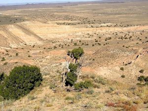
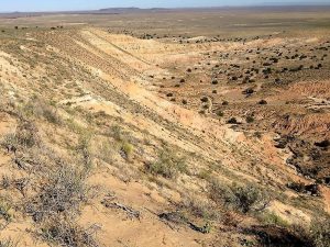
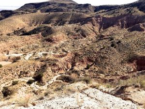
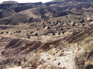
This hike has views to the West not usually seen, wildflowers, various colors of layers of rock formations.
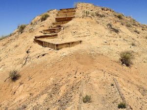
CautionsThere are some high steps at the time of major elevation gain, over 20 of them. Poles are recommended.
Trailhead DirectionsSouth on I-25 to Los Lunas Exit (203). West on NM 6 to just past mile marker 30 (about 4 miles). Turn left into trailhead parking which is well marked.
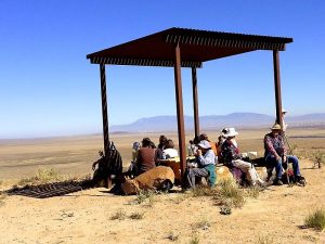
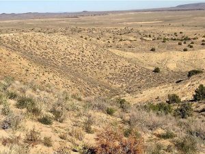
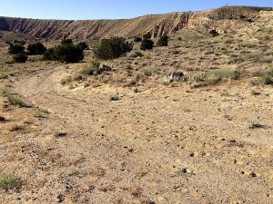
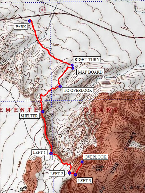
Actual HikeFrom parking area PARK go SE on fine gravel road to RIGHT TURN. Turn right across blocked drainage about a block to MAP BOARD. This presents the Los Lunas Open Space map of the area and the rules of usage. After consulting this continue to the right (South West) and gradually turning SE on the old gravel road. At TO OVERLOOK leave the road for the trail going South West (right). Between TO OVERLOOK and SHELTER are over 20 steps made of 2X12 and 2X14 lumber. They are HIGH steps. At SHELTER you will be on the SW edge of the BOWL. The trail stays close to the edge with LEFT 1, LEFT 2, and LEFT 3 all marked by low markers by the open space management. At OVERLOOK you will be on the East side of the BOWL with a good look at the strata, colors, and details to the mountains to the west from a position unusual for our local hikes. Returning to the SHELTER, the turns are not located for such good visibility going in this direction, so watch the route. Between the picnic table and large rocks at SHELTER a van of hikers can easily find seating accommodations for lunch. Again, watch the steps on the downhill return route.
CommentsThis hike would also be a fine winter hike in inclement weather when other planned routes are canceled because of weather. Spring and Fall should have flowers not found higher up.
WaypointsPARK: N 34 49.357, W 106 48.695
RIGHT TURN: N 34 48.968, W 106 48.235
MAP BOARD: N 34 48.942, W 106 48.229
TO OVERLOOK: N 34 48.778, W 106 48.362
SHELTER: N 34 48.558, W 106 48.553
LEFT 1: N 34 48.186, W 106 48.462
LEFT 2: N 34 48.014, W 106 48.264
LEFT 3: N 34 47.999, W 106 48.201
OVERLOOK: N 34 48.110, W 106 48.127
Hike GPS File Name: ElCerroDeLosLunas-BowlOverlook_KSKS.gpx
Hike GPS File: Click link to download hike waytrack file
Text Author: Theodore (Ted) Cooley
Map Author: Ken Smith
Waypoints Author: Ken Smith
Track Author: Ken Smith
Maintainer: Cathy Intemann
Editor: Marilyn Warrant