Rio Cebolla to Calaveras Canyon Hike
In Jemez Mountains Region
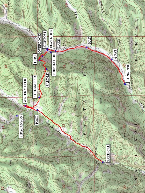
Map File Source: NG Topo
 Hike Key: H10379
Last Updated: 01/14/2021 12:00am
Last Updated By: Marilyn Warrant
Hike Class: D (Difficult)
Hike Distance: 5.3 mi
Minimum Elevation: 8072 ft
Elevation Change: 827 ft
Total Uphill: 881 ft
Total Downhill: 830 ft
Avg. Grade: 8 %
Route Type: Oneway
Protected: Yes
On Trail: No
Paved or Gravel Roads: No
GPS Advised: Yes
Drive Distance Round Trip: 165 mi
Drive Time One-Way: 1:45
Hiking Seasons: Spring, Summer, and Fall
New Mexico Game Unit: 6A
Hike Status: Published
Highlights
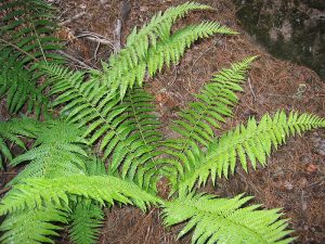
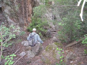
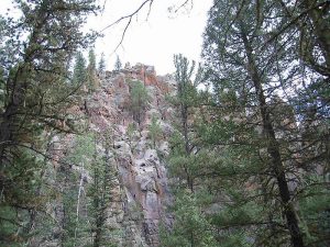
Travel an old, unmaintained blazed hiking trail up over the ridge between canyons. Ferns, rocks, and adventure.
CautionsVery steep sections requiring hiking poles.
Trailhead DirectionsThis hike is designed as a cross-over hike that requires two vans or a shuttle. For the Rio Cebolla trailhead, take SR 126 west from SR 4 at La Cueva. Take a right on FR 314, which is 3.2 miles beyond the end of the bridge that crosses the marsh at Fenton Lake, to the Seven Springs fish hatchery. Continue past the fish hatchery to the day use area, and PARK. The Calaveras Canyon trailhead is about another mile past the turnoff to Seven Springs. Look for a pullout large enough for two vans on the right. PARK-CAL here.
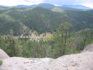
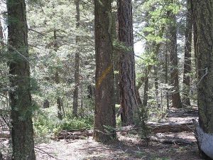
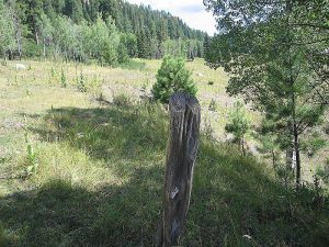
Actual HikeHike the trail along the left-hand side of the Rio Cebolla past OAT (0.5 mi) Canyon, HAY (1.0 mi) Canyon, and a LAKE (1.5 mi). After the LAKE, watch for a large FLAT ROCK (1.6 mi) in the trail. Go up to the left and find the SIGNPOST (1.6 mi) (the sign itself is missing that used to say “Calaveras Canyon 2 1/2 miles”). Follow the track closely to find an old, very steep (25% grade in places), blazed trail. Follow the trail to an OVERLOOK (1.8 mi) and enjoy a view of the valley below while you catch your breath. Soon after this, the trail takes a sharp TURN (2.0 mi) to the left then makes its way up to the SADDLE (2.3 mi). There’s an old road up there that goes along the ridge. Have lunch and meet the other group (if there is one) here. The trail down to Calaveras Canyon is marked with a cairn, visible from where you came up. After lunch, go down this trail, again following the blazes. There’s more deadfall on this side of the ridge that you’ll have to step over or go around, but the trail isn’t as steep. Stay on the left side of the STREAM BED (3.0 mi) and eventually you’ll come to a sizeable meadow. Take a right turn into Calaveras Canyon here. There’s a side canyon that starts between WATERMETER (3.3 mi) and POST (3.7 mi) to investigate if you have time. Then go down Calaveras Canyon southwest to PARK-CAL (5.3 mi) where you should find the other van or the shuttle.
CommentsJust be sure you don’t go too late in the fall (you don’t want to get mistaken for a deer or snowed in). This trail was described in the 1984 edition of “50 Hikes in New Mexico” by Harry Evans, but doesn’t appear to have been maintained in a long time. The blazes on the trees can be hard to see. The FOUNDATION is probably a remnant of the old Lazy Ray Ranch.
The hike class has been raised to “D” due to the very steep Cebolla Canyon section.
WaypointsPARK: N35 56.135, W106 41.009
OAT: N35 56.329, W106 40.574
HAY: N35 56.687, W106 40.361
LAKE: N35 57.126, W106 40.422
FLAT ROCK: N35 57.242, W106 40.392
SIGNPOST: N35 57.245, W106 40.410
OVERLOOK: N35 57.318, W106 40.513
TURN: N35 57.356, W106 40.589
SADDLE: N35 57.258, W106 40.746
STREAM BED: N35 57.362, W106 41.240
WATERMETER: N35 57.558, W106 41.386
POST: N35 57.386, W106 41.467
PARK-CAL: N35 56.455, W106 42.383
FOUNDATION: N35 57.195, W106 40.451
SIDECANYON: N35 57.681, W106 41.570
Hike GPS File Name: RioCebollatoCalaverasCanyonWayTracked_KSKS.gpx
Hike GPS File: Click link to download hike waytrack file
Text Author: Marilyn Warrant
Map Author: Marilyn Warrant
Waypoints Author: Ken Smith
Track Author: Ken Smith
Maintainer: Marilyn Warrant
Editor: Howard Carr