Rio en Medio West Hike
In Sangre De Cristos Region
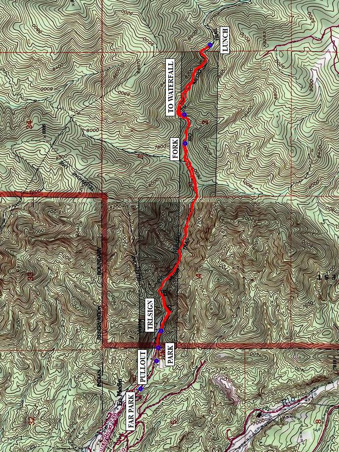
Map File Source: NG Topo
 Hike Key: H10301
Last Updated: 01/26/2023 2:12pm
Last Updated By: Marilyn Warrant
Hike Class: C (Challenging)
Hike Distance: 5.4 mi
Minimum Elevation: 7230 ft
Elevation Change: 1054 ft
Total Uphill: 1130 ft
Total Downhill: 1130 ft
Avg. Grade: 11 %
Route Type: InOut
On Trail: No
Paved or Gravel Roads: Yes
GPS Advised: Yes
Drive Distance Round Trip: 160 mi
Drive Time One-Way: 1:30
Hiking Seasons: Spring, Summer, and Fall
New Mexico Game Unit: 44
Hike Status: Inactive
Highlights
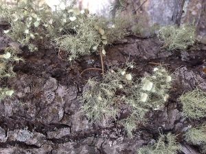
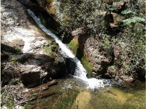
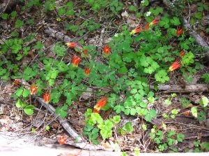
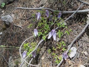
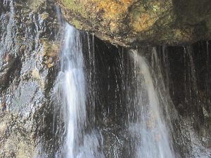
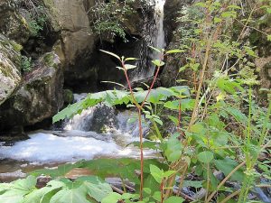
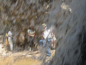
Cool hike along a stream; wildflowers; cascades; and finally, a tall waterfall that you can wade behind.
CautionsHiking poles recommended for steep sections and crossing the stream in several places. Water shoes recommended.
Trailhead DirectionsTake I-25 north from Albuquerque. Before you get to Santa Fe, take 599W to bypass Santa Fe. When you get to US84/285, go north to Exit 172 and exit to the right onto Hwy 73. Go for 0.4 mi and turn left onto Hwy 592. Stay on this road for about 6 mi, going through the village of Rio en Medio. (There is a sharp left turn after 3 miles on this road.) In the village continue past the church to PARK (0.0 mi). If there’s no room in the small parking area, there’s a PULLOUT with room enough for the van. Be sure to leave your wheels turned for a quick exit because someone may park in front and/or in back of you. If the PULLOUT is full, try back up the road aways.
Actual HikeWalk up the canyon on the dirt road, and watch for the Rio en Medio Trail to leave the road to your right at TRLSIGN (0.1 mi) (this is easy to miss). In a quarter mile the trail descends to the canyon floor and makes the first of numerous stream crossings. Soon the trail enters a mixed conifer forest. You may find parallel trails on both sides of the river in some places, but as long as they continue upstream, they will all eventually come together again. Staying on the main trail takes you to the top of a waterfall after a short steep climb (you can hear but not see it). Continue ascending up the canyon passing several cascades and shallow pools. Find a good place along the stream for LUNCH (2.9 mi). Return the way you came, this time turning right at TO WATERFALL (3.5 mi). Wade or walk carefully a short distance to a tall (for NM) waterfall that you can wade behind. You can also experience the other side of the stream by taking the trail to the right at the FORK (3.7 mi).
The Rio en Medio Trail continues along the stream all the way up to the Winsor Trailhead near the ski area.
CommentsWe will cross the stream many times and it may have a lot of water, so wear pants you can roll up if needed, shoes you don’t mind getting wet, and bring your hiking sticks for stability. Bring your water shoes if you want to wade through the pool to get behind the waterfall. July and August are good months to do this hike, after the spring snowmelt is mostly done. While the average grade is 11%, the middle part of the hike is steeper.
Affected by the 2020 Medio fire, so set Inactive.
WaypointsPULLOUT: N35 49.273, W105 53.705
PARK: N35 49.264, W105 53.608
TRLSIGN: N35 49.244, W105 53.485 (0.1 mi)
LUNCH: N35 48.926, W105 51.343 (2.6 mi)
TO WATERFALL: N35 49.107, W105 51.900 (3.5 mi)
FORK: N35 49.101, W105 52.112 7714.08 ft (3.7 mi)
Hike GPS File Name: RioEnMedioWestWayTrackRev_MW.gpx
Hike GPS File: Click link to download hike waytrack file
Text Author: Marilyn Warrant
Map Author: Marilyn Warrant
Waypoints Author: Ken Smith
Track Author: Marilyn Warrant
Maintainer: Marilyn Warrant
Editor: Howard Carr