Glorieta Canyon Hike
In Sangre De Cristos Region
Map File Source: DeLorme
 Hike Key: H10017
Last Updated: 12/15/2020 12:00am
Last Updated By: Marilyn Warrant
Hike Class: C (Challenging)
Hike Distance: 7.4 mi
Minimum Elevation: 7492 ft
Elevation Change: 1024 ft
Total Uphill: 1030 ft
Total Downhill: 1030 ft
Avg. Grade: 7 %
Route Type: InOut
On Trail: Yes
Paved or Gravel Roads: Yes
GPS Advised: No
Drive Distance Round Trip: 160 mi
Drive Time One-Way: 1:30
Hiking Seasons: Spring, Summer, and Fall
New Mexico Game Unit: 45
Hike Status: Published
Highlights
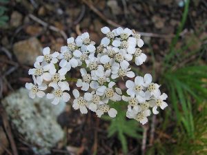
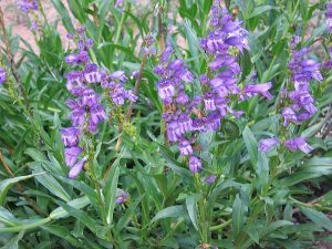
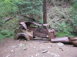
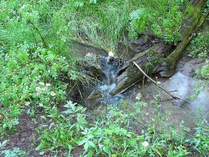
Ghost town, Glorieta creek, old truck. Wildflowers, mushrooms.
CautionsNone.
Trailhead DirectionsTake I-25 past Santa Fe, take Exit 299. Turn left onto the frontage road and go a short distance to the access gate. Enter access code 012 at the gate, and sign waivers/receive wrist bands at the small house inside the gate.
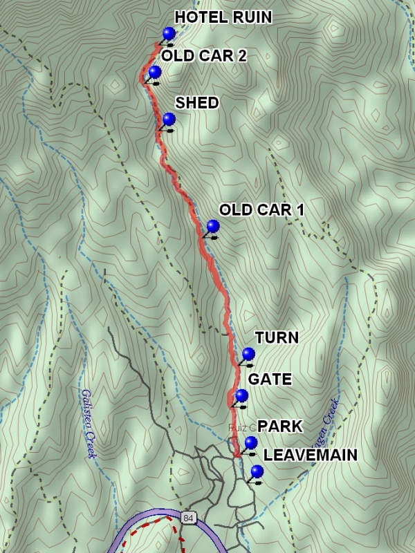
Actual HikeFollow the main trail (an old 2-track road) to the Ghost Town. It goes along a small stream through a wooded canyon after passing through open meadows. After the sign and trail off to the left that goes to Glorieta Baldy, go through a GATE (0.4 mi). Where a side stream joins the main stream, TURN (0.8 mi) to follow the main stream. The trail passes a couple of old wrecked cars of ’30’s vintage and a shed (OLD CAR 1 (1.9 mi), SHED (2.8 mi), OLD CAR 2 (3.3 mi)). At the second car there was an old sawmill and the bark scraps were left in a huge pile. Shortly thereafter you’ll find the HOTEL RUIN (3.7 mi). Have lunch there at the hotel, with a view of stunning rock towers to the east.
CommentsTo get permission to do this hike at the Glorieta Conference Center, contact Ellen Ward, Asst. Retreats Director. As of 2015, hikers are welcome by advance reservation mid-August through mid-May. Call 505-757-6161 for reservations. The liability waiver forms can be obtained in advance so hikers can sign them in the van.
Very tall pine trees, mosses, mushrooms, flowers in the canyon. It will take about two hours to reach the ghost town. The trail is very wide (old road bed) and well trodden. Depending on the year, the stream may be dry until you get partway up the trail.
WaypointsLEAVEMAIN: N 35 35.677, W 105 46.050
PARK: N 35 35.864, W 105 46.099
GATE: N 35 36.172, W 105 46.175
TURN: N 35 36.447, W 105 46.122
OLD CAR 1: N 35 37.286, W 105 46.409
SHED: N 35 37.986, W 105 46.761
OLD CAR 2: N 35 38.297, W 105 46.874
HOTEL RUIN: N 35 38.550, W 105 46.765
Hike GPS File Name: GlorietaCanyonWayTrack_MWMW.gpx
Hike GPS File: Click link to download hike waytrack file
Text Author: Marilyn Warrant
Map Author: Marilyn Warrant
Waypoints Author: Marilyn Warrant
Track Author: Marilyn Warrant
Maintainer: Cindy McConnell
Editor: Howard Carr