Holy Ghost Creek Hike
In Pecos Region
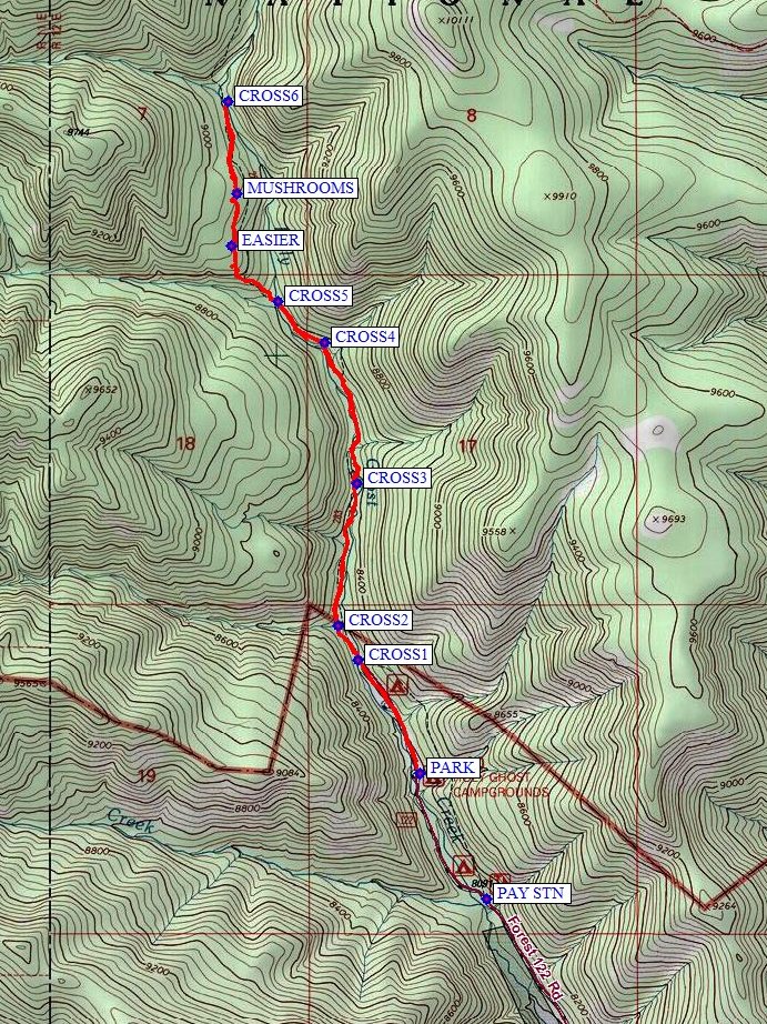
Map File Source: NG Topo
 Hike Key: H10016
Last Updated: 12/15/2020 12:00am
Last Updated By: Marilyn Warrant
Hike Class: C (Challenging)
Hike Distance: 4.8 mi
Minimum Elevation: 8190 ft
Elevation Change: 740 ft
Total Uphill: 810 ft
Total Downhill: 810 ft
Avg. Grade: 8 %
Route Type: InOut
On Trail: No
Paved or Gravel Roads: Yes
GPS Advised: Yes
Hiker Limit (NF/BLM/NP): 15 (Pecos Wilderness)
Drive Distance Round Trip: 190 mi
Drive Time One-Way: 2:00
Hiking Seasons: Summer and Fall
New Mexico Game Unit: 45
Hike Status: Published
Highlights
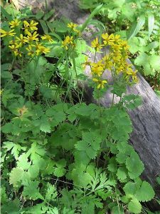
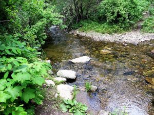
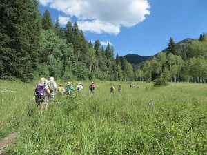
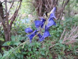
Meadows with wildflowers, stream crossings, good trail.
CautionsLikely some stream crossings using logs, though you can wade if you want. Bring hiking poles.
Trailhead DirectionsI-25 north past Santa Fe, Take exit 299 (Glorieta/Pecos). Follow SR 50 to Pecos where it ends at SR 63. For a rest stop, there is a Ranger Station 1/4 mile to right on 63 on your right (which is open weekdays but not Saturday). Otherwise go left on 63 for about 14 miles (milepost 18) almost to Terrero. Bear left just before bridge across Pecos River taking Holy Ghost Canyon Rd 122 to a PAY STN. Pay the $4 fee with Golden Age Passport then drive all the way to the end of the road to PARK (0.0 mi). You could avoid the fee and park just up from the PAY STN at the sign for Trailhead Parking, but then would have to walk about 0.5 mi on a paved road through the campground each way.
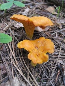
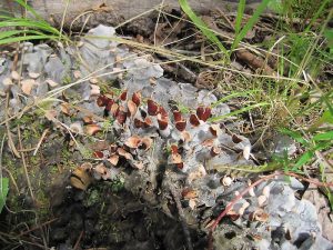
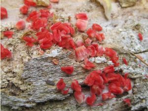
Actual HikeThe hike crosses the creek several times by logs (CROSS1 (0.4 mi), CROSS2 (0.5 mi), CROSS3 (1.0 mi), CROSS4 (1.5 mi), CROSS5 (1.7 mi)). The steepest part of the trail on the hike is between CROSS5 and EASIER (2.0 mi). You may find interesting MUSHROOMS (2.1 mi) after the trail levels off. Without requesting a late return, there’s usually enough time to go as far as the CROSS6 (2.4 mi) and eat lunch there. Return back to the van by the same trail.
CommentsJust getting there is half the fun. Nice drive passing Benedictine Monastery, Tres Lagunas subdivision (milepost 17) and expensive log homes along the magnificent Pecos River and Terrero, which was a gold mining town of 3,000 people at one time. Take time on the way in to admire the flowers in the various meadows. If there’s time, stop for ice cream at the little store just over the bridge where you go left coming in (with all the hummingbird feeders) or at the Dairy Queen (DQ) near Pecos.
The next stream crossing is about 1 mi further uphill. Climbing steeply, the trail eventually intersects Winsor Trail 254 at 9400′.
WaypointsDQ: N35 34.509, W105 41.763
PAY STN: N35 46.069, W105 41.861
PARK: N35 46.402, W105 42.076
CROSS1: N35 46.702, W105 42.277 (0.4 mi)
CROSS2: N35 46.791, W105 42.344 (0.5 mi)
CROSS3: N35 47.168, W105 42.282 (1.0 mi)
CROSS4: N35 47.540, W105 42.388 (1.5 mi)
CROSS5: N35 47.647, W105 42.537 (1.7 mi)
EASIER: N35 47.795, W105 42.687 (2.0 mi)
MUSHROOMS: N35 47.932, W105 42.671 (2.1 mi)
CROSS6: N35 48.176, W105 42.700 (2.4 mi)
Hike GPS File Name: HolyGhostWayTrackEd500.gpx
Hike GPS File: Click link to download hike waytrack file
Text Author: Roger Holloway
Map Author: Marilyn Warrant
Waypoints Author: Marilyn Warrant
Track Author: Marilyn Warrant
Maintainer: Marilyn Warrant
Editor: Howard Carr