Ravens Ridge to Deception Peak Hike
In Sangre De Cristos Region
Map File Source: NG Topo
 Hike Key: H10459
Last Updated: 12/05/2023 9:53pm
Last Updated By: Marilyn Fixer
Hike Class: E (Most difficult)
Hike Distance: 5.9 mi
Minimum Elevation: 10257 ft
Elevation Change: 2000 ft
Total Uphill: 2300 ft
Total Downhill: 2300 ft
Avg. Grade: 15 %
Route Type: CW Loop
On Trail: Yes
Paved or Gravel Roads: Yes
GPS Advised: Yes
Hiker Limit (NF/BLM/NP): 15 (Pecos Wilderness)
Drive Distance Round Trip: 150 mi
Drive Time One-Way: 1:45
Hiking Seasons: Summer and Fall
New Mexico Game Unit: 44
Hike Status: Published
Highlights
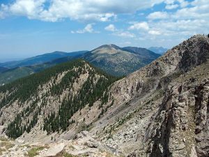
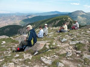
A strenuous hike with spectacular views of Nambe Lake, Santa Fe Baldy, and Lake Peak. Many wildflowers in summer, including those that grow above tree line.
CautionsA high-altitude hike with steep ascent and descent. Trekking poles recommended. Not recommended for hikers with respiratory disorders.
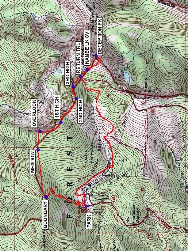
Trailhead DirectionsFrom Albuquerque take I-25 north to Santa Fe and take exit #284 north on Old Pecos Trail, which after about 3 miles becomes Old Santa Fe Trail, then turn right (east) on Paseo de Peralta. This street soon curves north and crosses the Santa Fe River where you turn right (east) on East Alameda St. Continue east about 0.75 mile and turn left (northeast) onto Gonzales Rd. Drive northeast just over 1 mile to Hyde Park Rd (NM 475) and turn right and drive about 14 miles to the Ski Area parking. PARK (0.0 mi) is on the northwest side near the privy and the trail information display board.
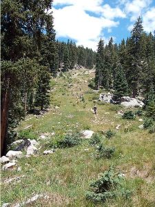
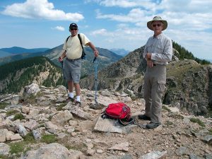
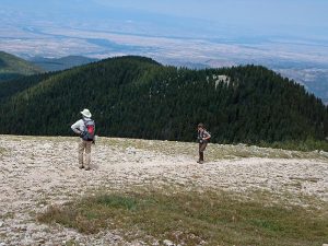
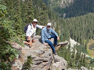
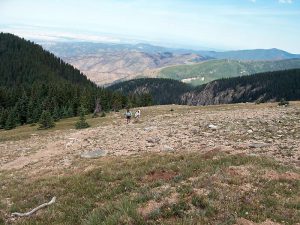
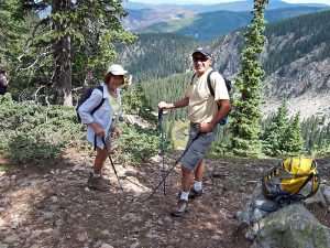
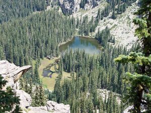
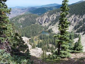
Actual HikeBegin hiking north on the Winsor Trail 254 up the hill and climb the switchbacks until the trail becomes less steep and you reach the top of the saddle and the Pecos Wilderness BOUNDARY (0.8 mi). The Winsor Trail continues straight ahead through the fence, but for this hike take the unmarked but easy-to-follow Raven’s Ridge Trail that heads right (east, northeast), parallel to the fence (do not cross fence). Follow wilderness boundary fence through the forest. You will pass a MEADOW (1.4 mi) on your left. A short distance further you will come to the end of the fence and an OVERLOOK (1.6 mi). Great views of Santa Fe Baldy, Lake Peak, and the Nambe Lake drainage below. The trail turns right (south, southeast) and climbs steeply up Raven’s Ridge. You will soon come to a boulder field with a scenic view (1.7 mi). Stay to the left of the boulders. There will be a second boulder field (1.8 mi). Stay on the left margin of the boulders. The trail reaches 1ST HIGH point (2.0 mi., 11,800 ft.), descends briefly and goes up to 2ND HIGH point (2.3 mi), then drops steeply down to a saddle. Always follow the ridgeline. The trail climbs to 3RD HIGH point (2.5 mi), only to descend once again. Look for spectacular views at NAMBE LK OV (2.8 mi) on your left. You will climb up again and reach the tree line and a lone bristlecone pine. The bare, rounded ridge ahead of you is Deception Peak. Follow the trail up to the ridge top. Turn left at the top and proceed toward the high point of DECEPTION PK (3.1 mi).
You may return the way you came for an In-Out hike or take an alternate route for a Loop. For the loop, retrace your steps for about 0.4 miles to RETURN TRL (3.5 mi). At this point there will be a faint trail to your left (southwest) and perhaps a cairn marking the spot. Follow this trail as it drops steeply off the ridge. You will soon reach a service/jeep road at the bottom . Turn right onto the road (west, southwest). Continue to follow the road. It makes several twists and turns and you will come to two different forks. Bear to the right at each fork (mostly west then northwest and finally west again). You will pass close to and under ski chair lifts and eventually pass through the main part of the ski area where there are several buildings. You will soon see the ski area gate leading to the parking lot and the Winsor Trailhead.
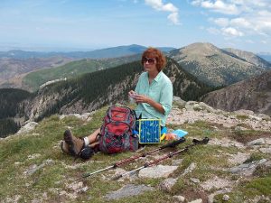
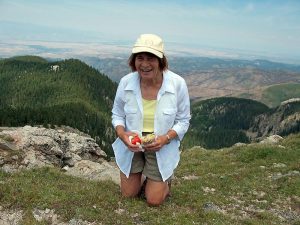
CommentsThe elevation of Deception Peak is almost 12,300 ft. The views are spectacular. The nearby peak to the northeast is Lake Peak, connected to Deception Peak by a narrow ridge. Santa Fe Baldy appears further back to the left of Lake Peak. To the west is the Rio Grande Valley, with the Jemez Mountains in the background. Tesuque Peak with its radio towers is within walking distance to the southwest. The hike class has been increased to E due to the high altitude.
If you go on this hike in early summer, you’re likely to see many flowers, including elephanthead, shooting star, marsh marigold, Colorado columbine, fireweed, and marsh primrose.
WaypointsPARK: N35 47.744, W105 48.293
BOUNDARY: N35 48.152, W105 48.180 (0.8 mi)
MEADOW: N35 48.235, W105 47.593 (1.4 mi)
OVERLOOK: N35 48.216, W105 47.362 (1.6 mi)
1ST HIGH: N35 48.005, W105 47.254 (2.0 mi)
2ND HIGH: N35 47.850, W105 46.958 (2.3 mi)
3RD HIGH: N35 47.879, W105 46.809 (2.5 mi)
NAMBE LK OV: N35 47.739, W105 46.600 (2.8 mi)
DECEPTION PK: N35 47.647, W105 46.422 (3.1 mi)
RETURN TRL: N35 47.807, W105 46.689 (3.5 mi)
Hike GPS File Name: RavensRidgeToDeceptionPeakWayTrackRev_DK.gpx
Hike GPS File: Click link to download hike waytrack file
Text Author: Dennis Kramer
Map Author: Marilyn Warrant
Waypoints Author: Dennis Kramer
Track Author: Dennis Kramer
Maintainer: Randy Simons
Editor: Howard Carr