El Malpais Narrows Hike
In El Malpais Region
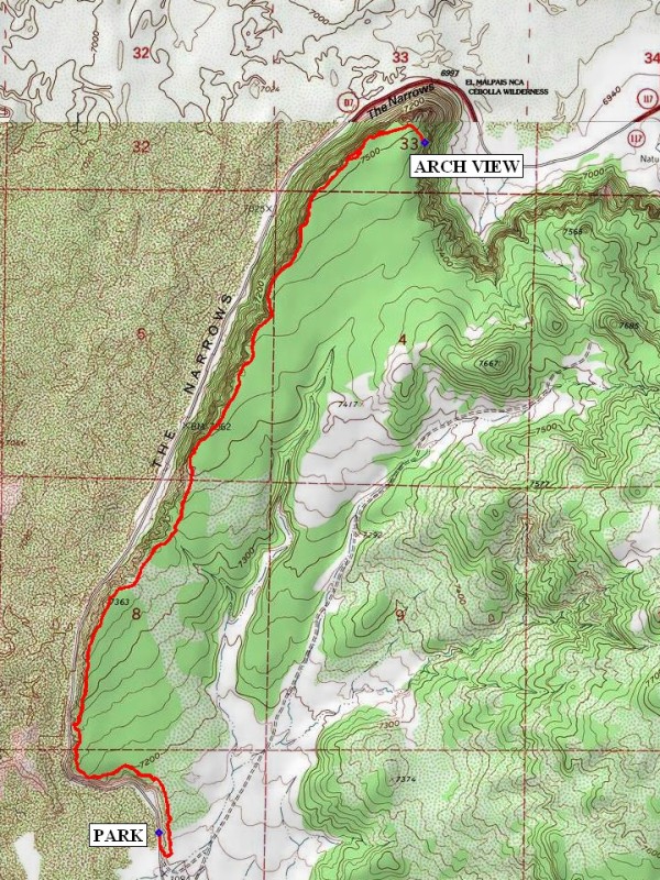
Map File Source: NG Topo
 Hike Key: H10130
Last Updated: 12/15/2020 12:00am
Last Updated By: Marilyn Warrant
Hike Class: C (Challenging)
Hike Distance: 7.7 mi
Minimum Elevation: 7109 ft
Elevation Change: 404 ft
Total Uphill: 585 ft
Total Downhill: 585 ft
Avg. Grade: 8 %
Route Type: InOut
On Trail: Yes
Paved or Gravel Roads: Yes
GPS Advised: No
Drive Distance Round Trip: 190 mi
Drive Time One-Way: 1:30
Hiking Seasons: Spring, Fall, and Winter
New Mexico Game Unit: 13
Hike Status: Published
Highlights
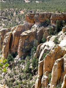
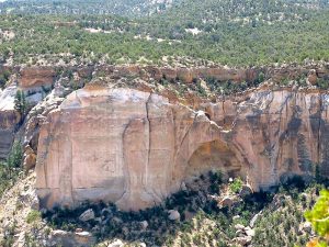
Mesa top hike with expansive views of El Malpais lava flows and La Ventana arch.
CautionsNone.
Trailhead Directions
From Albuquerque, take I-40 west for about 70 miles to Exit 89 at Grants. Go south for 22 miles on SR 117 into Malpais, past Acoma-Zuni Trail and Ventana arch. At 0.9 miles past milepost 36, turn left onto South Narrows Rd and PARK (0.0 mi) at small iron gate.
Actual Hike
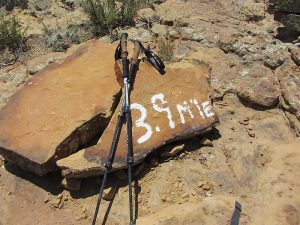
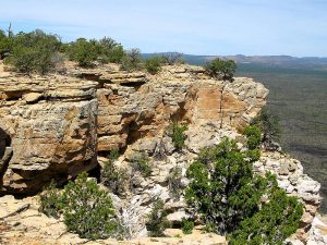
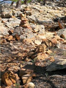
Trail starts to left of rock outcrop at left of iron gate. Climb up onto bluff and follow well-marked (rock cairns) trail northward following roughly the edge of the bluff to the ARCH VIEW (3.85 mi). Return to parking the way you came.
Comments
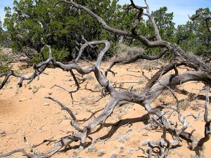
Trail alternates sandy with rocky but with gentle rise and fall. The hike as good views of the Malpais lava flow to the west of the bluff and road below.
WaypointsPARK: N34 50.227, W107 54.718
ARCH VIEW: N34 52.437, W107 53.686
Hike GPS File Name: ElMalpaisNarrowsWayTrack_DM (1).gpx
Hike GPS File: Click link to download hike waytrack file
Text Author: Dawn McIntyre
Map Author: Marilyn Warrant
Waypoints Author: Dick Brown
Track Author: Dawn McIntyre
Maintainer: Dawn McIntyre
Editor: Marilyn Warrant